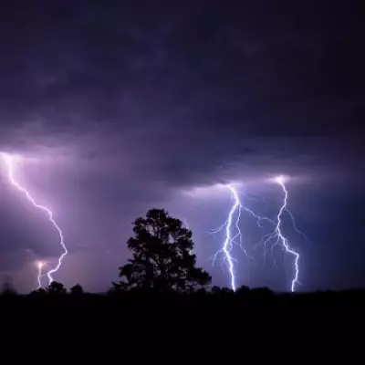
The Met Office has taken the drastic step of issuing its first red weather warning of the year, declaring a "danger to life" as Storm Goretti prepares to batter the United Kingdom. The monster weather system, named by Meteo France, is expected to make landfall within hours, bringing a devastating combination of violent winds, heavy snow, and torrential rain.
Met Office Issues Highest Alert for Southwest
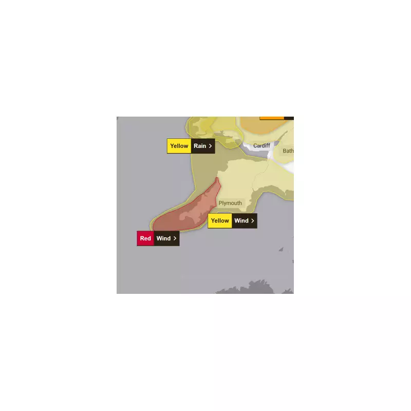
The rare and severe red warning is specifically targeted at the southwest coast, particularly Cornwall and the Isles of Scilly, where the storm's impact is forecast to be at its most ferocious. The Met Office has warned that wind gusts could reach between 80 and 100 mph in exposed coastal areas, with the potential for even higher speeds.
Forecasters characterise the incoming winds as "exceptionally strong" and warn they could cause significant damage to buildings and critical infrastructure. The public is advised to expect widespread power cuts, and huge, life-threatening waves are predicted along affected coastlines. The warning is active for Thursday evening, with the violent core of the storm expected to last for two to three hours before conditions begin to ease.

Three-Phase Onslaught of Wind, Snow and Rain
According to Jim Dale, chief meteorologist at British Weather Services, Storm Goretti will hit in three distinct and hazardous phases. "Wind will come first, snow second, and rain third - in that order," he explained to the Daily Mirror. "All have severe hazards attached to them, depending on where people live."
While the southwest bears the brunt of the wind, significant snow accumulations are expected elsewhere. Dale estimates that some regions could see snowfall depths of seven to eight inches (approximately 20cm), which will likely cause major travel disruption. Following the snow, a deluge of rain is predicted to sweep across eastern parts of the country from Suffolk to Hull late on Friday, with up to 60mm of rainfall threatening localised flooding.
Nationwide Disruption as Warnings Blanket the UK
The red warning is the most severe part of a broader tapestry of alerts covering much of the nation. A mix of yellow and amber warnings for wind, snow, and rain remain in force from the Met Office, with the last set to expire around 9pm on Friday.
The agency has urged people in the red warning area to avoid all non-essential travel and stay indoors where possible. The combination of hazards presents varying dangers across different regions:
- Southwest Coast: Extreme wind posing a direct danger to life, structural damage, and power cuts.
- Inland and Northern Areas: Heavy, disruptive snow leading to treacherous road conditions and potential transport cancellations.
- Eastern England: Heavy rainfall on Friday, raising the risk of surface water flooding.
The explosive intensification of Storm Goretti over Europe prompted the upgrade to the red alert, marking a severe start to the UK's weather year. Officials continue to monitor the situation closely, advising all citizens to heed the warnings and prepare for a period of dangerous and disruptive weather.