
Advanced weather modelling maps reveal that a significant snow event could be just days away from impacting the United Kingdom, with forecasts indicating a blizzard spanning approximately 600 miles. This extensive weather system is predicted to bring snowfall at a staggering rate of around four inches per hour in the most affected regions, potentially creating hazardous conditions across the country.
Detailed Timeline of the Approaching Snowstorm
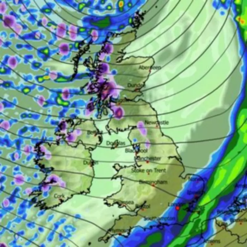
According to the ECMWF weather model, the initial flurries are expected to commence around 6am on March 6, first affecting Northern Ireland, western Scotland, and northern England. As the day progresses, the snowfall is forecast to intensify and spread significantly across additional areas.
Midday Expansion Across the UK
By midday on March 6, weather maps show snow falling across a vast geographical range, including the south-west of England, Wales, the north-west, and substantial portions of Scotland. The remarkable span from Plymouth in the south to the far north of Scotland represents a distance of roughly 600 miles, indicating the extensive nature of this weather event.

Where the snowfall is heaviest, particularly in western Scotland, meteorological data suggests precipitation could reach approximately four inches per hour. This intense snowfall rate could lead to rapid accumulation and potentially disrupt transportation networks and daily activities.
Concentration in Northern Regions
Maps for midday on March 7 indicate that the snow will then become concentrated primarily in Scotland and northern parts of England. By 6pm on March 7, the precipitation is expected to be confined mainly to western and northern Scotland, though still potentially falling at that same substantial rate of around four inches per hour.
During this period, temperatures in Scotland could drop to as low as -3°C, while other regions may struggle to rise above 2°C or 3°C. These chilly conditions combined with heavy snowfall could create challenging winter weather scenarios for residents and authorities alike.
Official Meteorological Perspectives
The Met Office has also indicated the possibility of snow towards the end of February and beginning of March. Their forecast for February 26 to March 7 states: "Changeable with Atlantic frontal systems spreading across the UK with drier and brighter interludes in-between. Rainfall will typically be heaviest in the west, with much less reaching sheltered eastern areas. Some snow is possible across high ground in the north. Winds will probably be strong at times, with a risk of gales. Temperatures are likely to be near to or slightly above normal."
Longer-Term Weather Outlook
Looking further ahead into March, the Met Office forecast for March 8 to 22 suggests: "Changeable conditions will probably dominate during this period, with Atlantic frontal systems spreading across the UK. These will bring spells of rain and perhaps strong winds, with the wettest conditions in the west and north. The southeast will likely be driest, perhaps with some long spells of dry weather developing for the south later. Temperatures are likely to be near to or slightly above normal overall."
This comprehensive weather analysis highlights the potential for significant snowfall across the United Kingdom in early March, with particular emphasis on the intensity and geographical spread of the predicted precipitation. Residents are advised to monitor official weather updates and prepare accordingly for potential winter weather disruptions.


