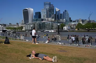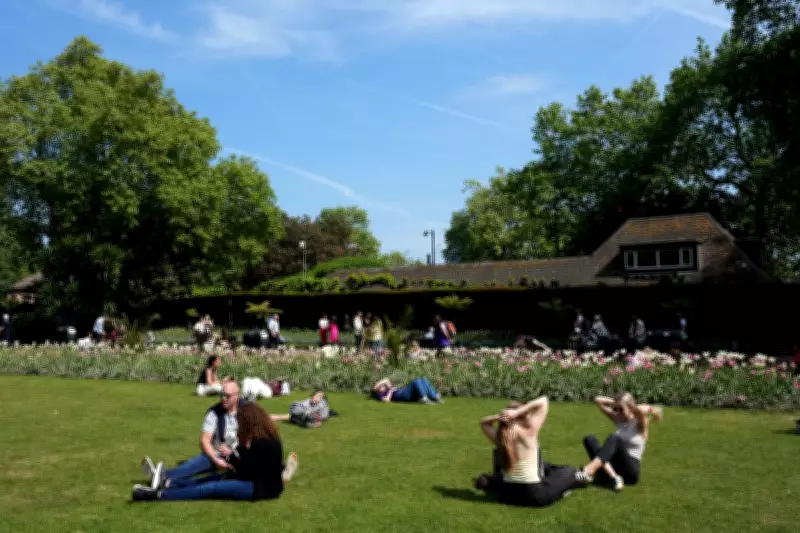
The United Kingdom is set to experience higher temperatures than Madrid this weekend, with the mercury climbing above 20 degrees Celsius in some regions. While this weekend's heat will not surpass the 25.4 degrees Celsius recorded in Kew Gardens and Heathrow last Friday, southern England can expect a pleasant Saturday with bright and dry spells after a grey and cloudy week.
Temperature Contrast Across the Country
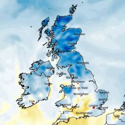
Many parts of the country have endured a chilly week, with temperatures dropping as low as minus 6.1 degrees Celsius in the Scottish Highlands. Altnaharra recorded the coldest May night in five years. However, the Met Office has indicated that warmer air will move into the south on Thursday and Friday, bringing the promise of a warm weekend for some areas.
Temperatures are forecast to peak at 21 degrees Celsius in London, with surrounding areas reaching 20 degrees Celsius. Parts of the South West and Wales will see warm temperatures in the late teens on Saturday afternoon. This will make it warmer than the Spanish capital, Madrid, where temperatures are predicted to reach only 18 degrees Celsius on Saturday before falling to 16 degrees Celsius.

In contrast, northern regions will experience much cooler conditions. Kendal will see 12 degrees Celsius, while Newcastle upon Tyne will only reach 9 degrees Celsius at its warmest. Scotland will similarly face these chillier temperatures, which will drop further into the evening.
Met Office Commentary
Met Office spokeswoman Nicola Maxey commented: "Conditions will begin to diverge later in the week, with warmer air pushing into the south on Thursday and Friday, bringing temperatures close to 20 degrees Celsius, while northern areas remain much cooler."
"This temperature contrast is likely to persist into Saturday, with the south potentially reaching the low 20s, but further north staying in the low teens at best. By Sunday, many areas should see some drier and sunnier weather, though temperatures will dip again. Temperatures next week are likely to remain on the cool or below-average side for early May."
Rainfall Forecast
Showers and longer spells of rain are expected to sweep across the north of England and parts of Scotland, moving further south overnight into Sunday. Guildford will experience heavy rainfall with 4 to 8 millimetres per hour overnight, while parts of Essex can expect steady drizzle on Sunday morning at 2 to 4 millimetres per hour.
Recent Weather Context
This weather pattern comes a month after the UK recorded one of its warmest April days on record. The hottest day of the year so far was 26.6 degrees Celsius at Kew Gardens on 8 April. The UK experienced its seventh warmest April on record and its fourth sunniest. Provisionally comparing this spring to last year's record-breaking spring, which was the warmest and sunniest on record, the forecaster noted that March and April had already recorded more rainfall than the whole of spring 2025. Last spring was the sixth driest since records began.
Detailed Forecast Until Weekend
Today: Many areas will be dry with some sunny spells. Scattered showers are expected, most frequent in the northwest. It will remain rather cool in the north, but temperatures closer to average in the south will make it feel a little warmer than Wednesday.
Tonight: A band of rain will move southeastwards across Scotland and Northern Ireland. It will be drier elsewhere with clear spells and a scattering of showers. Patchy fog and frost are possible under the clearest skies.
Friday: Bands of rain will move southeastwards across Scotland, Northern Ireland, and northern England. Sunny spells are expected elsewhere, but there is an increasing risk of showers developing. It will be warm in the south but chilly in the north.
Outlook for Saturday to Monday: The weather will remain changeable with showers and longer spells of rain at times. However, there will be some drier and brighter weather too. It will be cool in the north and warm in the south.