
Parts of the United Kingdom are digging out from what officials have described as potentially the worst snowfall in ten years, as Storm Goretti begins to slowly move away. The severe weather system swept in from the Channel on Thursday evening, bringing hurricane-force winds to the Isles of Scilly and Cornwall and blanketing much of the country with snow and ice.
Widespread Disruption and Extended Warnings
The Met Office had a raft of weather warnings in force on Friday, covering snow, ice, and rain. The disruption has been significant, with around 250 schools forced to close and travel networks severely impacted. While Storm Goretti is expected to edge away by the end of Friday, the reprieve will be brief.
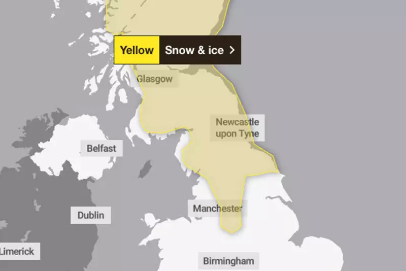
Forecasters have already extended three yellow weather warnings for snow and ice into Saturday. These warnings cover Scotland, large parts of Northern England, the Midlands, sections of the South West, Wales, and Northern Ireland. A specific warning for snow and ice runs from midday Friday until 3pm Saturday for northern England and Scotland, with further snowfall possible.

Another yellow ice warning is active for much of England and Wales from Friday midday until Saturday midday, as partially thawed snow refreezes overnight, creating hazardous conditions alongside wintry showers and freezing fog.
Further Snow Expected This Weekend
The weather alert does not end on Saturday. The Met Office has issued a further yellow snow and ice warning for Sunday, affecting Scotland, northern England, and parts of the Midlands. This new system could bring substantial accumulations, with up to 30cm of snow possible on high ground and around 5cm expected more widely.
This band of snow is forecast to move across the warning area on Sunday morning. Temperatures in the affected regions are predicted to hover around 2°C, largely above freezing but cold enough to sustain the wintry conditions.
Public Urged to Prepare for Ongoing Impacts
Authorities are advising the public to remain cautious. The Met Office has warned that the upcoming snow could lead to "possible delays" on roads, with a risk of vehicles and people becoming stranded. Residents in areas under warning have also been told to prepare for potential power cuts, which could subsequently affect mobile phone signal coverage.
The five-day forecast suggests a brief milder spell may arrive by Monday and Tuesday, but not before the country deals with another bout of disruptive winter weather this weekend.


