Britain is reeling from its most severe snowfall in a decade as Storm Goretti batters the nation, causing widespread travel chaos, significant power outages, and posing a serious danger to life. The storm, described by the Met Office as a 'multi-hazard event', has led to the grounding of flights at major airports, the closure of rail lines, and the blockage of numerous roads across the country.
Transport Network Brought to a Standstill
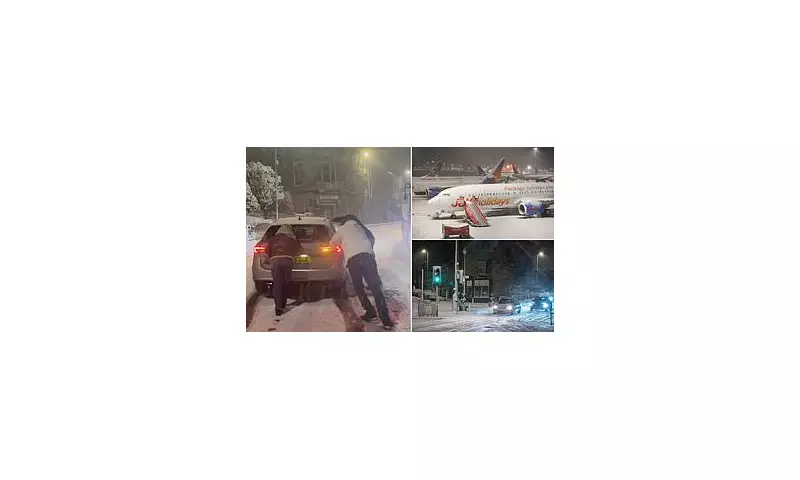
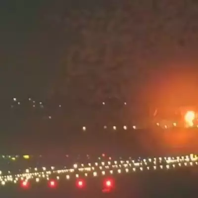
The impact on travel has been immediate and severe. Birmingham Airport was forced to suspend all runway operations on Thursday night after heavy snow made conditions unsafe. Dozens of flights were also cancelled at Heathrow due to the extreme weather, with airlines urging passengers to check the status of their journeys before travelling. Social media footage depicted planes shrouded in thick layers of snow and ice.
On the rails, Network Rail suspended all train services in Cornwall from 6pm on Thursday, with similar suspensions on key routes in Devon. Passengers were advised to complete journeys early, with no replacement road transport available due to treacherous conditions. The disruption is expected to continue into Friday morning, with many schools across affected regions announcing closures.
Red Warning Chaos and Widespread Power Failures
The storm's ferocity was most acutely felt in the southwest, where Cornwall was placed under a strict Met Office red warning – indicating a risk to life – until 11pm on Thursday. Residents were told to stay indoors as winds rocketed to speeds of up to 99mph around the Isles of Scilly. The warning highlighted the threat of structural damage, exceptionally large waves, flying debris, and prolonged power cuts.
This warning proved prescient, as the National Grid confirmed that over 65,000 properties were left without power on Thursday evening. The majority of these outages were concentrated in southwest England, with a further 11,000 properties affected in the West Midlands and several thousand in Wales.
A Nation Under Snow and Wind Alerts
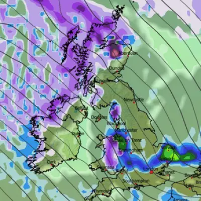
Beyond the red alert zone, much of the UK remained on high alert. An amber warning for snow was in force from Thursday evening until Friday morning, covering parts of Wales, the Midlands, and Yorkshire. Forecasters predicted 10-15cm of snow widely, with the potential for up to 30cm on higher ground in Wales and the Peak District. Separate yellow warnings for wind, snow, and ice covered vast swathes of the country, including Scotland.
Met Office Chief Forecaster Neil Armstrong stated: 'Storm Goretti will be a multi-hazard event, with the most significant impacts from snow in parts of Wales and the Midlands and the very strong winds in the far South West.' The storm has been linked to a phenomenon known as explosive cyclogenesis, or a 'weather bomb', due to its rapidly intensifying low pressure.
Dangerous Conditions Captured Across the UK
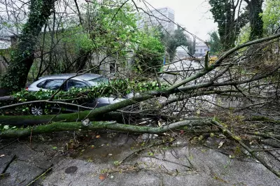
The storm's disruptive power was captured in images and videos from across the nation. They showed motorists in Cornwall navigating flooded country roads, journalists in Walsall battling to stand against fierce winds, and residents in Buxton, Derbyshire, pushing a vehicle stuck in deep snow. Fallen trees blocked roads in Falmouth, while abandoned cars and bicycles were pictured in Ruthin, Wales, buried under the snowfall.
With the clean-up operation beginning, authorities continue to urge caution. The Met Office's stark advice remains in place: 'You should avoid travelling, where possible, and follow the advice of the emergency services and local authorities.' As Storm Goretti slowly moves away, the UK is left to assess the full extent of the damage from this exceptional winter onslaught.


