
A powerful and slow-moving tropical cyclone has brought catastrophic flooding to communities across North Queensland, prompting a major emergency response. Tropical Cyclone Hayley made landfall early on Monday, 30th December, lashing the region with destructive winds and torrential rain that has led to rapidly rising floodwaters.
A Slow-Moving Storm Unleashes Torrential Rain
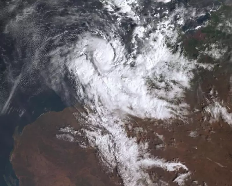
The core of the cyclone crossed the coast near the town of Innisfail, carrying sustained winds powerful enough to cause significant damage. However, meteorologists have emphasised that the greatest threat from Hayley is not the wind, but the immense volume of rainfall it is producing. The system's slow movement, at times barely progressing at walking pace, means it is dumping rain on the same areas for extended periods.
This has resulted in extraordinary rainfall totals. Some locations have recorded well over 600 millimetres of rain in just 24 hours, with the deluge continuing. The intense precipitation has overwhelmed rivers and creek systems, leading to flash flooding and causing major waterways like the Herbert and Johnstone Rivers to break their banks.

Widespread Damage and Mass Evacuations
The impact on local communities has been severe and swift. Emergency services have been conducting numerous flood rescues for people trapped in homes and vehicles. Authorities have issued multiple evacuation orders for low-lying suburbs in cities including Cairns and Townsville, urging residents to move to higher ground immediately.
Critical infrastructure has been badly affected. Thousands of properties are without power after winds brought down lines, and several major roads and highways are impassable due to floodwaters or landslides, isolating some towns. Cairns Airport has cancelled all flights, stranding travellers.
Local disaster coordination centres have been activated, and the Australian Defence Force is on standby to assist with logistics and potential evacuations if required.
Ongoing Threat and Climate Context
The immediate danger is far from over. The Bureau of Meteorology has warned that heavy rain will continue for the next 24-48 hours as the cyclone, now downgraded to a tropical low, moves further inland. This will likely cause further river rises and prolong the flooding crisis, with peak flood levels in some areas not expected until Tuesday.
This severe weather event occurs in a region familiar with cyclones, but scientists note that the intensity of rainfall associated with such storms is increasing due to warmer ocean temperatures. A warmer atmosphere holds more moisture, which can lead to more extreme precipitation events during tropical cyclones and intense low-pressure systems.
Residents in affected areas are being urged to follow the instructions of emergency services, avoid floodwaters, and stay informed via official warnings. The full scale of the damage will only become clear once the waters recede and access to isolated communities is restored.


