
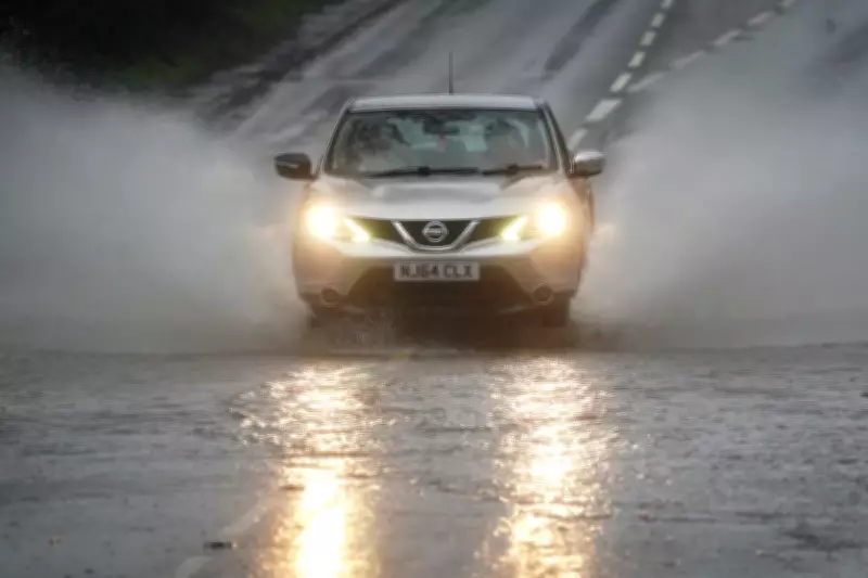
The United Kingdom is grappling with an exceptionally wet start to the year, having recorded rainfall every single day so far, amounting to 36 consecutive days of precipitation. This persistent damp spell follows a notably wetter than average January and shows little sign of abating, according to the latest forecasts from the Met Office.
Unrelenting Wet Weather Pattern
Met Office spokesperson Stephen Dixon confirmed the remarkable streak, stating, "Rain has been reported somewhere in the network every day of the year so far. While amounts are trivial on some days, and some areas will have seen dry days, the UK has seen a wet start to the year, particularly in Northern Ireland and southern England."
Dixon attributed the prolonged rainfall to "a succession of fronts or low pressure systems arriving from the west, bringing heavy rain at times, as well as damaging winds for some." He added that there's "little sign of a let-up in the current forecast, with further unsettled weather in the coming days and over the weekend."

Active Weather Warnings Across the Nation
The Met Office has issued multiple yellow weather warnings as the wet conditions continue. Two separate warnings for rain are currently in effect across south-west England, Wales, and Northern Ireland, while a third warning for snow covers parts of northern England.
The rain warning stretching from Chichester to Penzance covers substantial portions of south-east England, south-west England, and south Wales, remaining active from early Thursday morning until late Friday evening. Forecasters warn that "periods of rain and heavy showers are likely to cause surface water flooding in places," with rainfall expected to become "heavy and persistent" in some areas during Thursday morning.
Expected accumulations range from 10 to 20mm across most affected areas, with some locations potentially receiving more than 30mm. The Met Office has cautioned that flooding of some homes and businesses is possible, along with potential interruptions to power supplies and other essential services.
Northern Ireland's Exceptional Rainfall
A separate yellow weather warning covers parts of Northern Ireland from midday until midnight on Friday. The forecaster warned that "rain will be heavy at times and may lead to some flooding and travel disruption in places."
Most locations are expected to receive 10 to 20mm of rainfall, but south-east facing hills could see significantly higher accumulations of 40 to 50mm. The east and south-east facing slopes of the Mourne Mountains and Antrim Hills may experience particularly persistent rainfall, potentially receiving 60 to 80mm accompanied by strong east to south-east winds that could create difficult travel conditions and generate large waves along Irish Sea coasts.
This comes as Northern Ireland recorded its wettest January in 149 years, marking the second wettest January on record for the region. The exceptional rainfall was highlighted by Storm Chandra's impact on 26 January, when Katesbridge in County Down recorded a staggering 100.8mm of rain, far surpassing the previous site record of 38.2mm from 2005.
Record-Breaking Rainfall Events
Several other locations across the UK also experienced record-breaking rainfall during Storm Chandra. Dunkeswell Aerodrome in Devon reached 52.8mm, while Hurn in Dorset, Cardinham in Cornwall, and Plymouth Mountbatten in Devon all exceeded their previous daily rainfall records.
The snow warning for northern England, active from Thursday afternoon through early Friday morning, indicates that "rain will turn increasingly to snow over hills through this afternoon and evening," potentially leading to travel disruption in affected areas.
As the UK continues to experience this unprecedented stretch of wet weather, residents are advised to stay updated with the latest Met Office warnings and prepare for possible travel disruptions and localised flooding across multiple regions.


