
UK Braces for 500-Mile Blizzard and -8C Freeze This Weekend
Weather maps reveal the precise timing of a massive 500-mile blizzard set to batter the United Kingdom as temperatures plummet to a bone-chilling -8C. An Arctic Maritime air mass is advancing slowly across the nation, ushering in significantly colder conditions from northern Scotland southwards.
Exact Date and Impact of the Widespread Snowfall
According to the latest forecasts, the heaviest and most extensive blizzard will strike early on Sunday. The Met Office confirms that this Arctic air mass will gradually introduce colder weather, leading to widespread snow and rain across large swathes of the country.
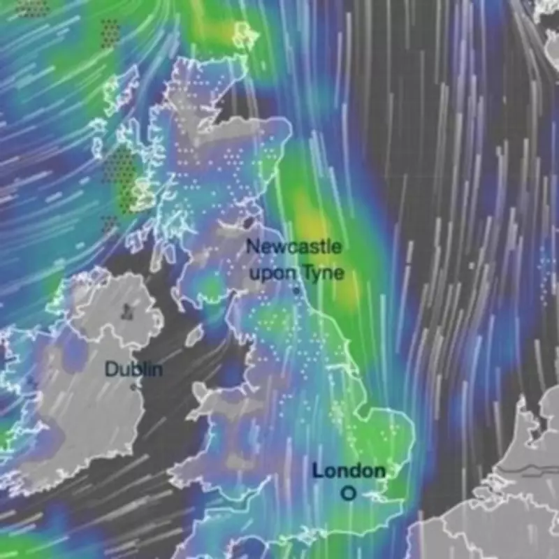
The striking weather map displays a continuous white hue indicating snowfall stretching approximately 500 miles from Aberdeen in the northeast to Cromer in Norfolk along the North Sea coastline. Snow showers are expected to reach parts of the Midlands, including Leicestershire and Northamptonshire, by around 6am on Sunday.

Regional Snowfall Predictions and Temperature Plunge
The most substantial snowfall is anticipated on the North York Moors and the Yorkshire Dales. However, in other areas, any dusting is unlikely to remain on the ground for a significant period. Jason Kelly, a chief forecaster at the Met Office, provided detailed insights into the expected conditions.
"Any settling snow will mainly be confined to high ground," Kelly explained. "Locations above 200 metres in Scotland and northern England may see 2-5cm of snow, but those above 300 metres could experience double those amounts, up to 10 cm."
As the rain and snow clear southwards, temperatures will drop rapidly under clear skies, potentially causing ice to form on untreated surfaces. The blizzards will be most persistent across North Yorkshire and East Yorkshire, continuing until mid-morning.
Extended Forecast and Flooding Concerns
The unpleasant weather pattern is projected to resume into next week, with around 38 inches of snow forecast to batter 24 cities as far south as Worcester and Peterborough. Scotland will bear the brunt of these later conditions, particularly parts of the Highlands.
Temperatures will continue to fall throughout the weekend, plunging on Sunday to feel as cold as -8C in parts of the East of England and North Yorkshire. Although the actual air temperature will hover around freezing, strong southwesterly winds will create a much colder sensation.
Nick Finnis, a forecaster at Netweather, commented on the service's blog: "The band of rain, sleet and snow clears eastern areas Sunday morning followed by drier, perhaps brighter conditions for a time, but showers across the west, which could be wintry in nature over the mountains, will spread east."
Increased Flood Risk and Current Warnings
The anticipated snow and rain are expected to heighten the risk of flooding, which has already damaged homes and businesses in Worcester, Tewkesbury, and other locations along the River Severn this month. Dozens of flood warnings remain in place across the country.
Multiple alerts are active in the Southwest of England, including concerns about groundwater in the Cerne Valley in Dorset. Residents are advised to stay informed through official channels and take necessary precautions as this significant weather event unfolds.


