A powerful storm system is poised to unleash severe gales and torrential downpours across the United Kingdom from Tuesday, with forecasters warning of a heightened risk of flooding and disruption.
Storm System Set to Strike
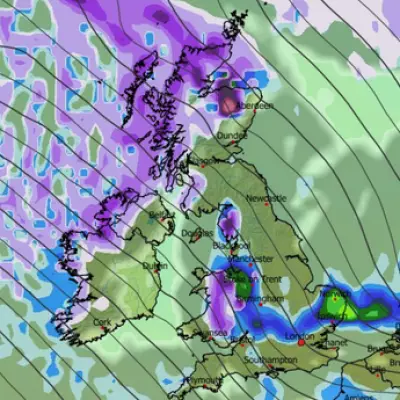
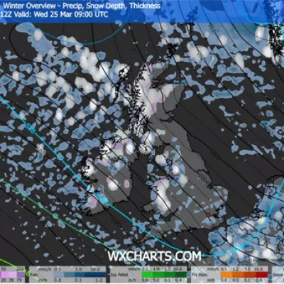
According to the latest weather maps and Met Office analysis, a deep area of low pressure will sweep in from the southwest later on Monday. This system is expected to bring a barrage of heavy rain and violent winds, with gusts potentially reaching 65mph. The severe weather is forecast to affect most of the country between late Monday and early Wednesday.
The heaviest rain on Tuesday morning is initially expected across south Wales and parts of Devon, before slowly moving northwards. By lunchtime, rainfall is likely to be widespread. The strongest southwesterly gusts will be felt along coastal areas, particularly in Devon and north Wales, as well as inland across the Peak District.
Flooding Risk and Existing Warnings
The impending storm significantly increases the danger of flooding, especially in regions where the ground is already saturated from recent rainfall. More than 31mm of rain lashed west Wales on Friday, while Camborne in Cornwall endured 26.6mm. Several flood warnings are already in place for areas including Dorset and Devon.
High tides, strong winds, and large waves may cause flooding even before Tuesday in locations such as Plymouth Sound, Wembury Bay, and nearby tidal estuaries. The Met Office has indicated that further severe weather warnings are likely to be issued over the weekend as the storm's trajectory becomes clearer.
"This system has the potential to cause disruption, and severe weather warnings are likely to be issued," said Steven Keates, Deputy Chief Meteorologist at the Met Office. "We therefore urge people to keep up-to-date with the latest Met Office forecast."
Milder Temperatures Now, Colder Snap Ahead
Temperatures during this storm are not expected to be cold enough for snow, with the mercury having reached 13C on the Isles of Scilly recently. However, a shift to much colder conditions is anticipated later in the month.
The Met Office's long-range forecast suggests temperatures will plummet again in the run-up to Christmas, with it feeling as cold as -6C in Aberdeenshire and -2C in the Welsh Valleys. This cold snap is predicted to continue intermittently through the festive period.
For the immediate weekend, low pressure will remain in charge, though rainfall is expected to be less intense than the incoming Tuesday system. Showers will be slow to clear northeastern Scotland on Saturday morning, with wet conditions forecast for north Wales in the afternoon.


