
New weather modelling maps have revealed the staggering scale of an approaching winter storm that is predicted to bury up to ninety percent of the United Kingdom under a thick blanket of snow, with accumulations reaching a monumental sixty-nine inches in some regions.
A Nationwide Whiteout
The latest data from the advanced ECMWF weather model indicates a severe blizzard will sweep across the country commencing on February 9. The initial snowfall is expected to impact South Wales, southern England, the Peak District, the Yorkshire Dales, the Pennines, and parts of Scotland.
As the day unfolds, the snowfront is projected to expand dramatically, engulfing the vast majority of the nation. By 6am on that date, heavy snow is forecast to be falling across most of England, Wales, and Northern Ireland.

Major Cities on Alert
Residents in several major metropolitan areas should prepare for significant disruption. The weather maps suggest that London, Birmingham, Nottingham, Manchester, Liverpool, Cardiff, and Belfast will all experience the arrival of the white stuff.
The snowfall is then expected to continue its march northwards, reaching the north of England and Scotland around midday. This means cities like Newcastle, Edinburgh, Glasgow, Aberdeen, and Dundee are also likely to see substantial flurries.
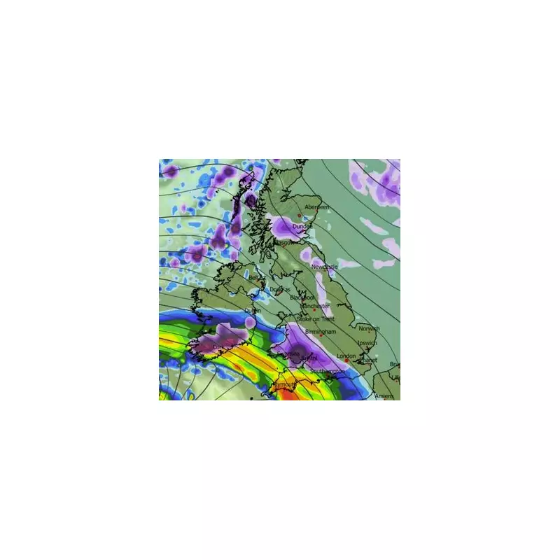
Projected Snow Depths
Snow depth charts illustrate the extreme nature of this impending weather event. The most staggering accumulations are forecast for the Scottish highlands, where as much as 175 centimetres, equivalent to sixty-nine inches, could settle.
Other regions are also braced for considerable snowfall:
- South Wales: Up to 20 centimetres (eight inches).
- Northern England: Around 8 centimetres (roughly three inches).
- Southern England: Similar accumulations to the north are on the cards.
- Northern Ireland: As much as 4 centimetres (1.5 inches) could settle.
The modelling suggests that by midday on February 9, approximately ninety percent of the UK's landmass will be covered in snow.
Met Office Forecast Aligns
The national Met Office has also indicated a heightened risk of wintry conditions throughout February, corroborating the severe scenario presented by the weather maps. In its forecast for the period of February 9 to 23, the agency warns of potential "wintry hazards."
The forecast states: "With the jet stream likely further south than normal, the wettest conditions are more likely in central and southern areas. North and northwestern parts of the UK are most likely to be drier than normal. Whilst mild incursions of wet and windy weather are favoured at times in the south and west, colder conditions in the north and northeast will bring an increased risk of wintry hazards, especially where any precipitation from the southwest interacts with the cold air."
Earlier Snow Risk
The Met Office also notes that snow could arrive even before the major blizzard. Its outlook for January 30 to February 8 adds: "Rain may be heavy and persistent, especially in the south and west. Whilst mild conditions are expected to encroach into the south and southwest at times, cold air is likely to be positioned to the northeast, bringing wintry showers at times. Where fronts from the southwest do reach the cold air towards the northeast, there is the risk of some snow, most likely across hills, but perhaps extending to lower areas at times."
This confluence of forecasts points to a period of significant winter weather disruption, with the public advised to stay updated on official warnings and prepare for potential travel delays and hazardous conditions.


