Weather maps across the United Kingdom have lit up in dramatic shades of red, signalling a period of intense and potentially disruptive rainfall set to drench the nation in the coming weeks. Forecasters are warning millions of Britons to brace for significant downpours as an unstable and changeable pattern takes hold towards the end of January.
Widespread Deluge Forecast
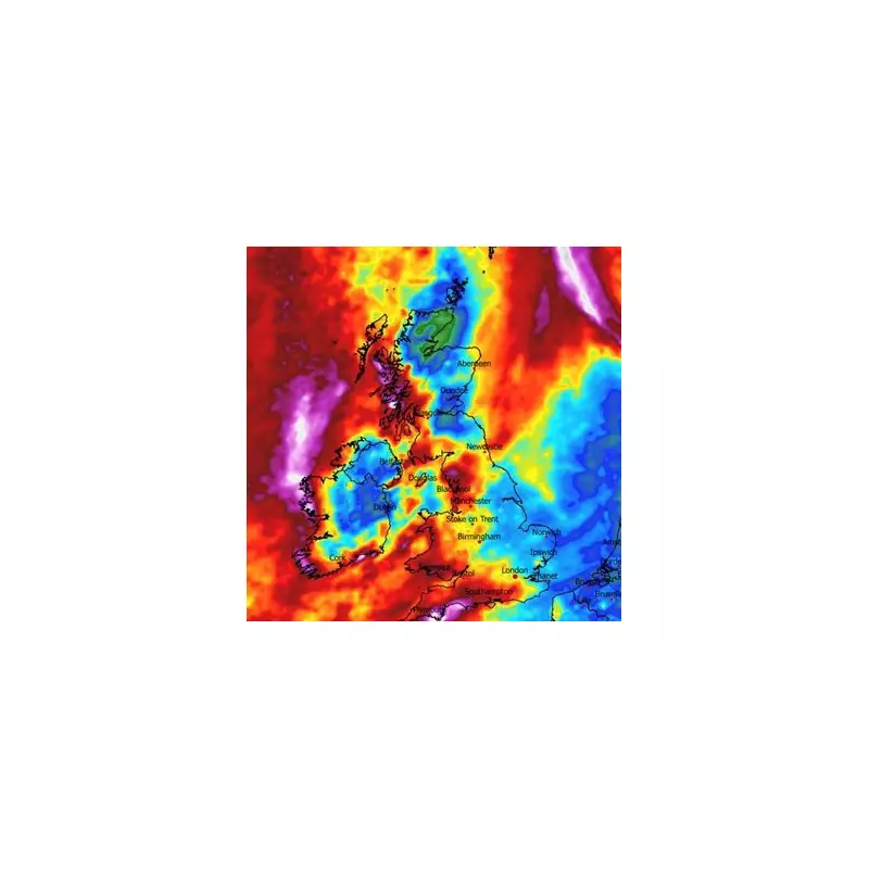
According to detailed projections from WXCharts, which utilises data from Metdesk, some regions are poised to receive a substantial soaking. Southern England, southern Wales, and north West Wales could see as much as 1.7 inches (approximately 43mm) of rainfall. This level of precipitation is not isolated, with the Lancashire and Cumbria coastline expecting similar totals. Western Scotland is also forecast to face a comparable deluge, painting a picture of a wet and windy period for much of the country.
The Met Office has echoed these concerns in its national outlook for the period spanning January 17 to January 26. Their forecast indicates that the weather will be highly changeable, driven by a series of low-pressure systems moving in from the Atlantic Ocean. This pattern is expected to bring frequent showers and longer spells of rain to many areas.

Met Office Outlook and Potential Hazards
The national weather service stated that these Atlantic systems will dominate, leading to unsettled conditions. "Wet weather will probably be most prevalent across western areas," a forecaster explained, but issued a significant caveat. Given the potential for these low-pressure systems to become slow-moving near the UK, heavy rain is possible anywhere at times, not just in the typically wetter west.
The forecast also highlights the risk of periods of windy weather accompanying the rain. While there will likely be some drier and more settled interludes, mainly towards the east, the overall picture is one of disruption. Temperatures are expected to be near normal for the time of year, but the Met Office notes the possibility of colder spells in the north and east. This cooler air could bring with it the potential for winter hazards, such as frost, ice, and even wintry precipitation on higher ground.
Specific Dates and Cumulative Impact
Weather maps pinpoint January 22 as a date of particular concern, with heavy rainfall predicted to affect a large swathe of the UK. The wet conditions are not expected to be a one-day event; projections suggest rain will continue for several consecutive days, increasing the risk of localised flooding, especially in southern parts of the country where ground may already be saturated.
Over the course of this unsettled spell, some regions could see cumulative rainfall totals reaching up to 2.9 inches. This persistent wet and windy weather is likely to cause travel disruption, affect outdoor plans, and will require the public to stay updated with the latest forecasts and any warnings issued by the Met Office or the Environment Agency.