Britain is braced for a dramatic return of wintry conditions, with advanced weather modelling indicating that parts of the country could be buried by snow within the next 24 hours. The forecast suggests a potent weather system will sweep in from the Atlantic, bringing a mix of disruptive snow and heavy rain.
Timeline of the Wintry Blast
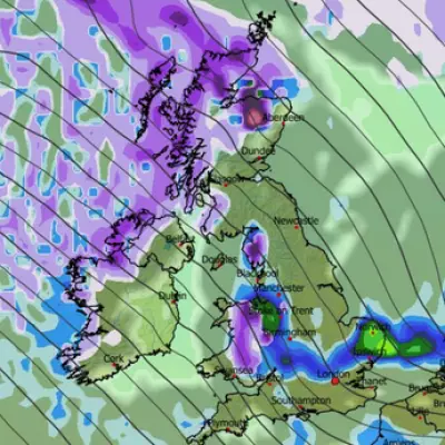
According to the latest GFS model data, the first snowflakes could begin to fall across Scotland and northern England from around 6pm on Friday, December 5th. This initial band of precipitation will also drive heavy rain into Northern Ireland, Wales, and much of England.
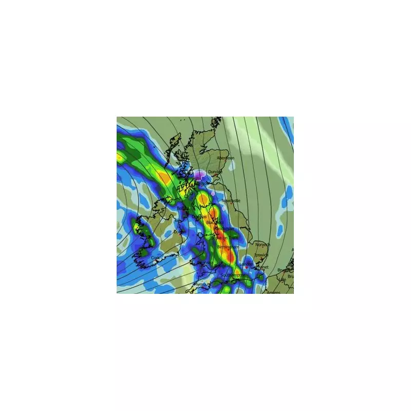
The situation is expected to intensify rapidly. By 9pm on Friday, the maps project intense snowfall concentrating around the Lake District, the Pennines, southern Scotland, and parts of the Highlands. Concurrently, the heaviest rain is forecast to lash the east coast of England.

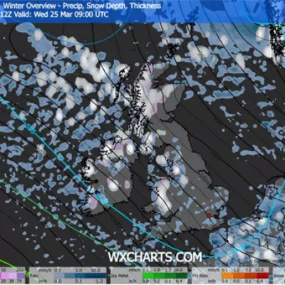
The wintry conditions are predicted to persist into the early hours. Maps for around midnight show snow continuing to fall over Scotland, with Glasgow directly in the firing line. Areas south of Edinburgh may also see accumulation. Notably, snow coverage maps suggest flakes could settle on the ground as far south as the Peak District, with some eastern towns like Redcar potentially impacted.
Met Office Outlook and Immediate Warnings
While this short-term blast is signalled by advanced modelling, the Met Office's broader forecast suggests the greater likelihood of sustained snowy weather will arrive later in December. Their outlook for December 19th to January 2nd indicates a changeable period with rain, showers, and strong winds, especially in the west and northwest.
"Hill snow is also a possibility, mainly in the north," the forecast states. "However, there is a greater chance of spells of high pressure during this period... This will increase the chances of overnight fog and frost."
More immediately, the national weather agency has issued a yellow weather warning for fog covering East Sussex, Kent, Surrey, and West Sussex. This warning comes into force on Thursday night and lasts into Friday morning.
Visibility could drop below 100 metres in places, and patches of ice may form on untreated surfaces following rain on Thursday. This adds a significant layer of travel hazard ahead of the anticipated snow.
Preparing for Disruption
The combination of freezing fog, followed by potential snow and ice, signals a period of considerable disruption for parts of the UK. Travel conditions are likely to be difficult, particularly over higher routes in the north and through the fog-affected southeast in the morning.
Residents are advised to stay updated with the latest forecasts and travel information. The advanced maps provide a detailed snapshot, but conditions can change rapidly. Preparing for potential travel delays and ensuring homes and vehicles are ready for colder weather is now a pressing priority as this Arctic blast makes its approach.