Millions of residents across the Great Lakes and Northeastern United States are facing severe weather warnings as a rapidly intensifying winter storm, known as a bomb cyclone, barrels towards them.
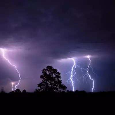
What is a Bomb Cyclone?
The National Weather Service (NWS) issued the critical alerts on Monday, cautioning that this is no ordinary winter system. A 'bomb cyclone' or bombogenesis describes a low-pressure system that undergoes a period of exceptionally rapid intensification, leading to extreme and dangerous weather conditions.
Meteorologist Brandon Buckingham from AccuWeather explained that the storm is strengthening swiftly as it moves across the Midwest and Great Lakes. "The storm will bring risks of heavy snow, ice, severe thunderstorms, powerful wind gusts, and heavy rain," Buckingham stated, highlighting the multifaceted threat.

Major Cities in the Path
The system is on a direct collision course with several key metropolitan areas. The forecast path places Green Bay, Chicago, Detroit, Indianapolis, Pittsburgh, Washington DC, Philadelphia, New York City and Boston directly in line for significant impacts.
Forecasters warn that snowfall totals in parts of the Great Lakes could be staggering, potentially reaching up to two feet. As colder air moves in on Monday, a brief period of wintry mix is expected to transition into heavy snow, creating whiteout conditions and causing travel to deteriorate rapidly.
Widespread Disruption Expected
By Tuesday, as the storm continues to intensify, some regions could be buried under six to 10 inches of snow. The combination of heavy precipitation, ice, and powerful winds poses a serious risk to infrastructure, power supplies, and road safety across a vast swathe of the country.
This remains a developing weather event, with further updates anticipated as the bomb cyclone tracks across the United States. Residents in affected areas are urged to monitor official warnings from the National Weather Service and prepare for severe disruption.