
Britain is bracing for a rare and potentially hazardous weather phenomenon next week, as forecasters issue warnings for specific regions in England. The country continues to grapple with treacherous conditions in the aftermath of Storm Chandra, with new threats emerging on the horizon.
Targeted Alert for Northern Counties
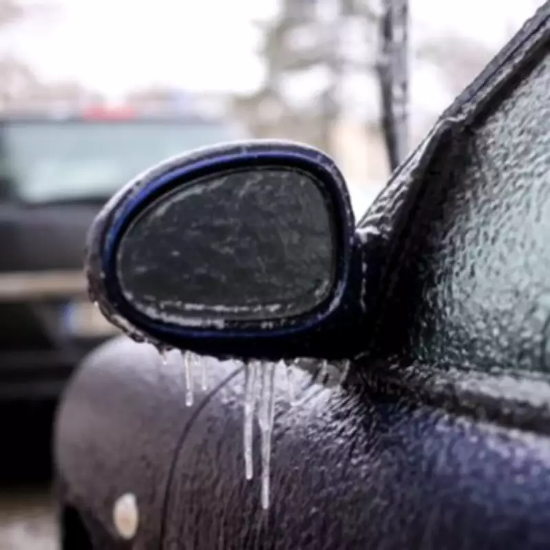
On February 12, parts of Northumberland and North Yorkshire are expected to experience freezing rain, an unusual form of precipitation that poses significant risks. This rare event occurs when liquid raindrops hit cold surfaces and crystallise almost immediately, creating a glazed ice coating that can lead to dangerous travel conditions and infrastructure disruptions.
Meteorological Conditions Behind the Phenomenon
Freezing rain requires very particular atmospheric conditions, which explains its relative rarity across the UK. Typically, it begins as snow, ice, sleet, or hail that passes through a warmer layer of air above 0°C during descent, transforming into liquid water droplets. If these droplets then encounter a sub-zero air pocket just above ground level, they become supercooled. Upon contact with surfaces at or below freezing point, they instantly freeze, coating everything in a transparent sheet of ice.

Maps from WXCharts.com highlight the affected regions in orange, indicating where this uncommon weather event will impact the country. The Met Office's long-range forecast for February 7 to February 16 provides context for the broader weather patterns influencing this phenomenon.
Broader Weather Patterns and Impacts
The Met Office report states: "Frontal systems over the Atlantic, steered by a south-shifted jet stream, are likely to approach the UK at times, but tending to stall as they encounter a blocking area of high pressure to the north and northeast. This will result in further spells of rain at times, falling in areas already sensitive to flooding."
As these bands of rain spread northwards, some snow is possible in northern England and Scotland, mainly over higher ground, as they meet colder air. The forecast adds: "A subtle shift southwards of these areas of low pressure is anticipated during the second week of February, which may allow a greater chance of colder air to spread across larger parts of the UK at times, including the south, bringing an increased risk of wintry hazards."
Meanwhile, substantial rainfall is forecast to batter much of the rest of the nation, with up to 1.2 inches expected in certain areas, particularly across west Wales. Certain parts of Scotland are also bracing for snow, based on meteorological data from WXCharts.com.
Rarity and Spectacular Effects
When freezing rain does occur in the UK, the results can be quite spectacular, as raindrops momentarily spread across surfaces before solidifying. This creates a hazardous layer of ice that can affect roads, pavements, and power lines, increasing the risk of accidents and outages.
Residents in Northumberland and North Yorkshire are advised to stay informed through local weather updates and take necessary precautions as the date approaches. The combination of ongoing treacherous conditions and this rare event underscores the importance of vigilance during the winter months.


