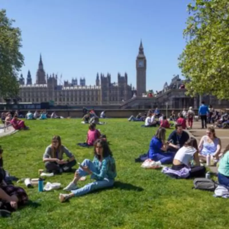
Britons are set to enjoy a burst of summer sun as a mini-heatwave sweeps across the UK today, with temperatures soaring to 21°C in parts—hotter than Greece. The Met Office forecasts a welcome warm spell, with 27 areas expected to see higher temperatures than Thursday and generally less windy conditions, stretching from Liverpool in the north to Bude in the south.
Warm Spell Across the Country
Maps indicate temperatures will rise as the day progresses, with a mix of lows of 10°C by midday in northern parts and highs of 17°C down south. By late afternoon, temperatures are expected to reach around 19°C in major UK cities including London, Glasgow, Manchester, and Birmingham. In Glasgow, the Scottish Fire and Rescue Service has warned of a "very high" risk of wildfires as temperatures reach 20°C today, potentially rising to 21°C over the weekend.
Weekend Outlook
Tonight is predicted to be dry, paving the way for another sizzling day on Saturday. Met Office deputy chief forecaster Steven Keates said high pressure would "remain broadly in charge" through the weekend, with most places staying dry and sunny. He noted: "As is often the case, there are a few exceptions, with cloudier conditions for some at times and patchy rain possible for northern Scotland later in the weekend. But in the sunshine, we’re expecting temperatures to steadily climb, likely peaking in the low 20s on Friday and over the weekend. Onshore breezes will keep some coastal areas somewhat cooler."

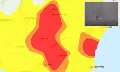
27 Areas Forecast for a Heatwave
The 27 areas expected to experience the warm spell include: Glasgow, Liverpool, Manchester, Andover, Bristol, Wells, Salisbury, Gillingham, Winchester, Yeovil, Bridgwater, Taunton, Bude, Barnstaple, Colwyn Bay, Bangor, Caernarfon, Porthmadog, Barmouth, Machynlleth, Aberystwyth, Aberaeron, Cardigan, Llandeilo, Penrhiw-Llan, Burry Port, and Monmouth.
Regional Temperature Details
Additional forecast data from WXCharts, based on MetDesk modelling, indicates that the warm spell will move across parts of England and Wales by Saturday April 25, with the highest temperatures focused on the South and the Midlands. London is forecast to be among the warmest locations, reaching highs of 21°C, while nearby counties such as Berkshire and Surrey are also set to experience unusually warm conditions for April. Surrounding areas, including Kent, Crawley, and Reading, are expected to see temperatures peak at around 20°C. Further west, Worcestershire and the wider West Midlands are likely to enjoy warm conditions, with highs of 21°C and nearby areas hovering around 19°C.
More broadly, regions from Leeds southwards—including the Midlands, Wales, the South East, and South West—are expected to see temperatures ranging between 17°C and 21°C, with many areas settling around 18°C to 19°C. Conditions will be cooler further north, with Scotland expected to see temperatures between 7°C and 9°C in many areas. Parts of the Scottish Highlands—particularly around Dumfries and Galloway—could experience warmer spells of up to 17°C, while the Lake District may reach highs of around 16°C.
Long-Range Forecast
The outlook comes as the Met Office suggests largely dry and sunny conditions as April draws to a close. In its long-range forecast covering April 28 to May 7, it says high pressure is likely to remain centred, bringing predominantly dry conditions with a mix of cloudier spells and sunnier days. For the most part, rain is expected to be kept at bay, though the far west and northwest may see some showers at times. The Met Office adds that temperatures will continue to sit above normal.