
Storm Chandra Triggers Amber Weather Warnings Across Southwest England
The Met Office has implemented an amber warning for rain across seven specific areas in southwest England as Storm Chandra batters the UK. This significant weather alert, active from 5pm today until 9am tomorrow, warns residents of potential heavy rainfall, flooding, and considerable disruption to daily life.
Critical Flood Risk and Public Safety Advisory
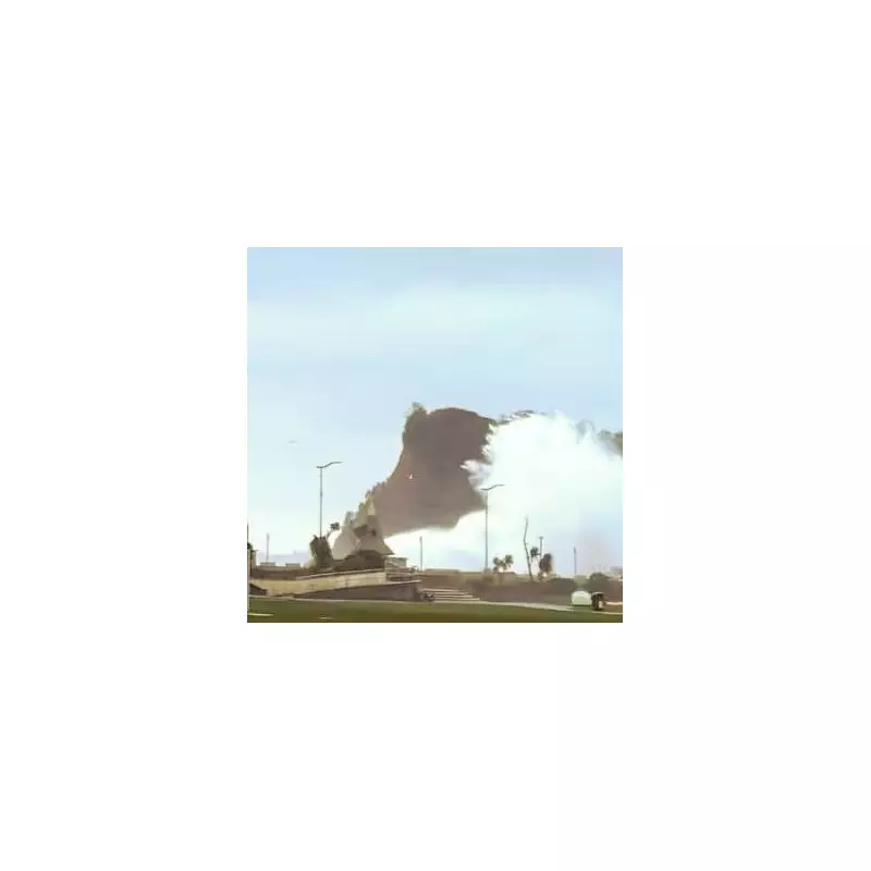
Forecasters have issued stark warnings about the potential impacts of the incoming storm system. Homes and businesses in vulnerable locations are likely to experience flooding, which could cause structural damage to properties. More alarmingly, the Met Office has highlighted that fast-flowing or deep floodwater presents a genuine danger to human life.
Transport networks are expected to face severe disruption, with probable delays and cancellations to both train and bus services across the affected regions. The weather service has also warned about possible power cuts, difficult driving conditions, and some communities becoming completely cut off due to floodwaters. In certain prone locations, there is an additional risk of landslides occurring.

Essential Seven-Item Flood Kit Recommendations
To help residents prepare for potential flooding incidents, the Met Office has strongly advised those in vulnerable areas to assemble an emergency flood kit containing seven vital items. This proactive measure is designed to protect individuals and families from loss or damage to their homes and businesses.
The recommended flood kit should include the following essential items:
- Insurance documents and other important paperwork
- A reliable torch with spare batteries
- A comprehensive first aid kit
- Any necessary prescription medicines
- Essential supplies for family members and pets
- Warm, waterproof clothing and blankets
- An adequate supply of food and drinking water
Geographic Impact and Rainfall Predictions
The amber weather warning specifically covers seven local authority areas in southwest England:
- Bournemouth, Christchurch and Poole
- Cornwall
- Devon
- Dorset
- Plymouth
- Somerset
- Torbay
Meteorologists predict that 30-50mm of rain could fall widely across these regions, with higher ground areas of south Dartmoor potentially experiencing significantly heavier downpours of 60-80mm. This follows recent severe weather incidents, including Storm Ingrid which caused substantial damage to a historic pier in Devon just days ago.
Additional Weather Warnings Across the UK
Beyond the amber alert in southwest England, the Met Office has issued several additional weather warnings as Storm Chandra continues to affect different parts of the country. A yellow warning for rain remains in effect from 1pm today until 10am tomorrow, covering extensive areas including:
- Southeast England (Hampshire, Isle of Wight, Oxfordshire, Southampton, West Berkshire)
- Southwest England (multiple counties including Bristol, Gloucestershire, and Wiltshire)
- Wales (sixteen counties from Blaenau Gwent to Vale of Glamorgan)
- West Midlands (Herefordshire and Shropshire)
Northern Ireland is also experiencing weather disruptions, with five counties under a separate warning from midday until midnight tonight. Looking ahead to tomorrow, forecasters anticipate continued challenging conditions with amber warnings for both rain in southwest England and wind along the eastern coast of Northern Ireland.
Wind, Snow, and Flooding Concerns Nationwide
The storm system is creating multiple weather hazards across different regions. In eastern Northern Ireland, unusually strong easterly winds are expected, with gusts reaching 60-70mph generally and potentially hitting 75mph in exposed coastal locations. The Met Office has emphasized that winds of this magnitude from an easterly direction are particularly unusual and likely to cause significant impact.

Further north, the interaction of Storm Chandra with colder air masses is creating snow hazards. Yellow warnings for snow have been issued for Scotland and northern England, where 2-5cm could accumulate widely, with higher elevations potentially seeing 10-20cm of snowfall. Separate yellow wind warnings also cover Cornwall, southwestern Wales, and parts of northern Devon.
The Environment Agency reported that as of 1pm on Monday, 21 flood warnings and 124 flood alerts were active across England, with most concentrated in the South West region and two specific warnings around York.
Expert Meteorological Assessment
Met Office Chief Forecaster Paul Gundersen provided detailed analysis of the complex weather situation: "Initially, strong winds will impact the Isles of Scilly, western Cornwall and south-west Wales which are still vulnerable after Storm Goretti, with gusts of 70 to 80mph possible in these areas."
He continued: "Heavy rain presents an additional hazard as it falls on already saturated ground in Dorset and southern parts of Devon, Somerset and Cornwall. As Chandra interacts with colder air further north, snow becomes a significant hazard, with 10-20cm possibly accumulating over higher ground in the Pennines, southern Scotland and the Highlands."
Gundersen concluded with important advice for the public: "With such a complex spell of weather developing, it's absolutely crucial that people stay up to date with the latest forecasts and any specific warnings issued for their local area."


