The United Kingdom is preparing for a weekend of further disruptive weather, with fresh snowfall and widespread flooding expected as tens of thousands of households remain without electricity in the wake of Storm Goretti.
Widespread Warnings and Ongoing Disruption
Following a week of severe conditions that forced school closures and crippled travel networks, yellow weather warnings for snow and ice remain active across large parts of the country until Sunday. The situation is particularly acute in the South West of England, where around 28,000 properties were still without power on Saturday morning according to the National Grid.
Forecasters have warned that the combination of melting snow and persistent rain could trigger significant flooding in the coming days. In response, the Environment Agency had issued 129 flood warnings and alerts across England on Saturday. Rail services are expected to face continued disruption throughout the weekend in England, Wales, and Scotland as the nation grapples with the storm's aftermath.

Detailed Forecast and Health Alerts
A specific yellow warning for snow and ice is in place until 3pm on Saturday for parts of northern England and much of Scotland, where an additional 2-5cm of snow is forecast, with 10-20cm possible on ground above 200 metres. A separate ice warning covers large swathes of England and Wales until midday on Saturday, as partially thawed snow refreezes, creating hazardous conditions accompanied by wintry showers and freezing fog.
In a serious health development, the UK Health Security Agency (UKHSA) has extended its amber cold weather health alert for all of England until Monday, cautioning about a potential 'rise in deaths' due to the prolonged cold spell.
Met Office meteorologist Dan Stroud stated the weekend weather would stay "unsettled and cold." He explained: "Wintry showers will continue to affect some coastal areas on Saturday... It will be a widely cold day, with frost lingering across parts of the country." Looking ahead to Sunday, he warned of rain moving eastwards, which will fall as snow across the north Midlands and further north, though rising temperatures may confine it to higher ground later in the day.
Storm Impact and Damage Assessment
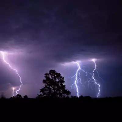
Storm Goretti, which was named by French forecaster Meteo France, proved to be a destructive "multi-hazard event." It brought a peak gust of 99mph to St Mary's on the Isles of Scilly—the highest recorded there since 1991. Significant snow accumulations were recorded across the UK, including 27cm at Altnaharra in Sutherland, Scotland, and 15cm at Lake Vyrnwy in Powys, Wales.
The storm's ferocious winds caused extensive damage. On the tidal island of St Michael's Mount off Cornwall, the head gardener reported more than 80 trees were lost, describing the devastation as ten times worse than any previous storm in his decades there. The island's weather station recorded winds of 111mph before a power cut took hold.
Transport networks were severely impacted. Airports including Birmingham and East Midlands suspended operations due to heavy snow on Friday, while Heathrow cancelled at least 69 flights. All trains in Cornwall were axed, and roads were blocked by fallen trees, with one incident in Truro seeing two large trees crash through a house roof and onto three cars.
Other incidents included shipping containers falling from vessels off the Isle of Wight and significant damage to the roof of the Cornish Pirates rugby stadium in Penzance. The wild weather also contributed to coastal erosion concerns, with properties being demolished on cliffs at Hemsby in Norfolk due to collapse risks.
With the government facing calls to convene the Cobra emergency committee, the UK now watches and waits as the clean-up begins alongside the threat of further winter weather.