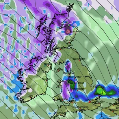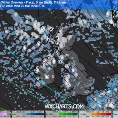
Britain is bracing for a potentially freezing festive period as new weather data suggests a significant snow event could arrive on Christmas Day. The latest forecasts indicate a cold snap, dubbed a potential 'Beast from the East', may sweep across from Europe, bringing wintry conditions to mark the holiday.
Christmas Day Snow Maps Signal Wintry Blast
According to the latest projections from WXCharts, which utilises MetDesk data, a band of snow is predicted to move across Europe and reach the UK from the east on December 25. The maps indicate that some mountainous regions could see significant accumulation, with parts of Scotland, northern England, and Wales in line to be blanketed.
The snowfall is shown spreading from the south towards the north throughout Christmas Day, expected to reach Scotland by the late afternoon. While the Met Office has not yet confirmed a white Christmas, its long-range forecast supports a trend towards colder, more unsettled weather in the lead-up to the holiday.
Unsettled Conditions and Flood Warnings Precede Festive Chill
Before any potential snow, the UK is contending with severe wet weather. The Met Office has issued several warnings, including an amber rain alert for parts of Wales active until 9pm on Monday, December 16. Forecasters warn of 50mm to 80mm of rain widely, with nearly 100mm in some spots, leading to probable flooding of homes and businesses, dangerous fast-flowing water, and power cuts.
Additional yellow rain warnings cover parts of north-east, north-west, and south-west England, the East and West Midlands, and Wales. The Environment Agency has issued seven 'flooding expected' warnings and 79 alerts, highlighting the saturated ground's vulnerability.
Met Office spokesman Stephen Dixon stated that while rain will ease for many on Tuesday, bringing clearer skies and a chill, wet and windy conditions will return widely on Wednesday, further affecting sensitive areas in south Wales and south-west England.
Long-Range Forecast: Frost, Fog, and Falling Temperatures
The national forecaster's outlook from Saturday, December 20 to Monday, December 29 suggests a shift. There is a greater chance of high pressure developing near the UK, which would reduce the likelihood of impactful rain or strong winds but increase the risk of overnight frost and stubborn fog. Temperatures are expected to gradually fall closer to seasonal averages.
Looking further ahead, from Tuesday, December 30 to Tuesday, January 13, high pressure will likely maintain dry, settled weather. This pattern brings a continued potential for frost and fog, with lower-than-average temperatures, though nothing exceptionally cold is currently signalled. More changeable conditions may reassert themselves towards mid-January.
Travelers are urged to stay updated with the latest forecasts and warnings, especially given the current flood risks and the potential for disruptive winter weather as Christmas approaches.


