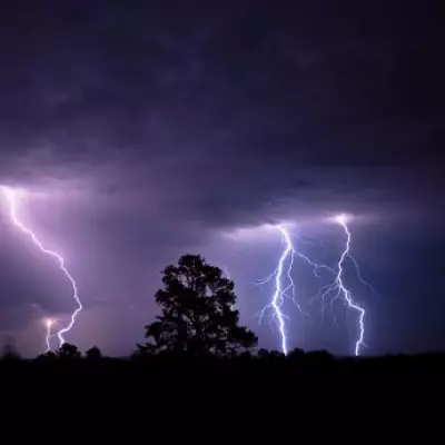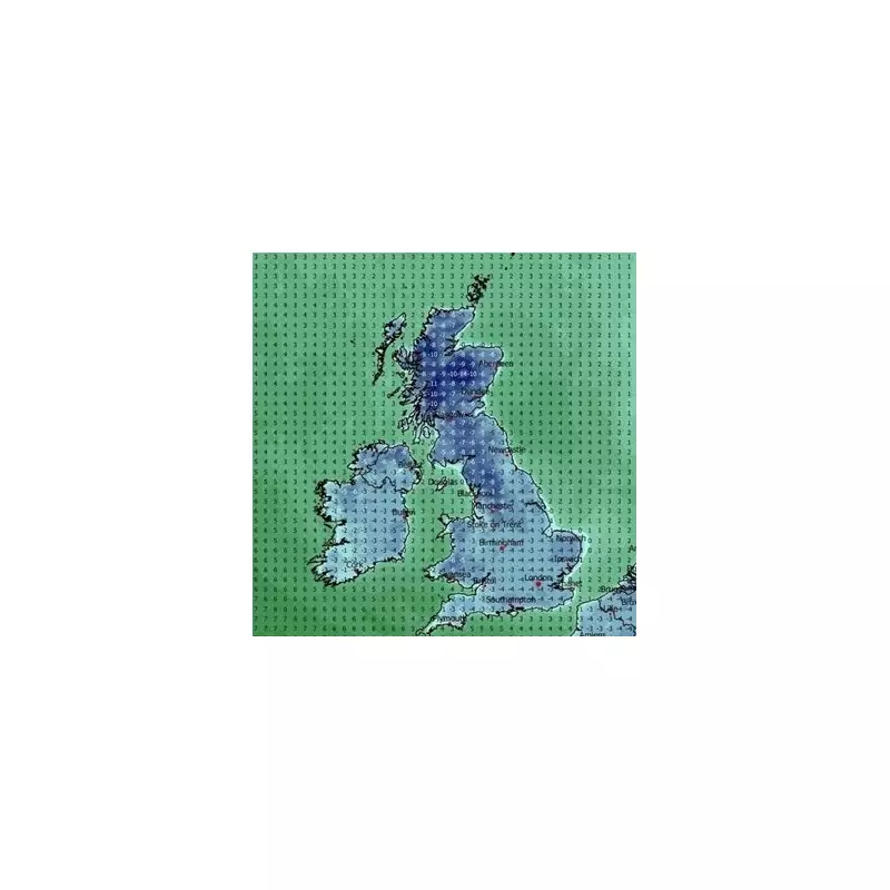
Britons are preparing for a brutal start to the New Year as weather maps turn a foreboding dark blue, signalling an imminent and severe Arctic blast. Forecasters warn the UK is set for a week-long deep freeze, with temperatures potentially dropping as low as -14C and more than 40cm of snow accumulating in some regions.
The cold air has already begun its descent, with frigid northern air sweeping across the country. This has prompted advice for the public to wrap up warm for any remaining New Year festivities. However, the situation is expected to deteriorate significantly, according to the latest models from WX Charts, which indicate the UK will be in the grip of an intense cold snap from January 4 until January 10.
Week-Long Deep Freeze: Day-by-Day Forecast
The cold spell will bring widespread sub-zero lows overnight, with daytime highs struggling to climb much above freezing for the entire period. The collision of low-pressure systems from the west with the entrenched cold air will generate significant snowfall, expected to blanket the country from north to south by January 6.

January 4: The freeze takes hold. Daytime highs will be limited to a mere 1C to 3C for most, with temperatures plunging after dark. By midnight, northern Scotland could see -10C, while much of the UK will experience an overnight low of around -4C.
January 5: The cold intensifies. By midday, only parts of southern England may creep above 0C. A severe freeze sets in by 6pm, with the entire nation dropping well below zero. Widespread temperatures of -6C to -8C are expected overnight, with areas near Aberdeen in Scotland potentially hitting a bone-chilling -14C.
January 6: This is forecast to be the coldest night of the period. By early evening, temperatures will fall below -5C across much of the UK. Eastern England, including parts of Norfolk, could see -7C.
Snow Accumulation and Ongoing Hazards
January 7: Hazardous frost and ice will make travel difficult, especially in rural areas. Daytime temperatures may see a slight increase to around 5C in central England, but Scotland braces for another bitterly cold night, with lows of -12C.
January 8: This day could see the heaviest snow accumulations. WX Charts indicate up to 43cm of snow in western Scotland and up to 17cm in northern England. Daytime highs will be around 2C or 3C in England, while Scotland remains locked at highs of -7C, dropping to -10C overnight.
January 9 & 10: The cold air maintains its grip, with only southern England briefly reaching above 0C during the day. Scotland will see highs of around -5C. While the cold begins to ease slightly on the 10th, widespread frost and ice will continue to cause disruption.
Official Warnings and Long-Range Outlook
The Met Office has highlighted that winds will usher in the Arctic conditions, bringing snow showers to areas exposed to onshore winds. The forecaster stated: "Subtle day-to-day changes in wind direction will change the places most exposed to the showers, but where they occur, some significant accumulations of snow are likely."
They also warned of bands of sleet and snow moving south, bringing a risk of more widespread wintry precipitation. While uncertainty increases in the second week of January, the cold conditions may persist with an ongoing risk of winter hazards across the UK.
Residents are urged to stay updated with the latest forecasts, prepare for significant travel disruption, and take necessary precautions to protect themselves and their properties from the extreme cold and snow.