
UK Flood Warnings: Over 70 Areas on Alert as Met Office Issues Ice Warning
The Met Office has issued a yellow weather warning for ice across parts of the UK today, as more than 70 flood warnings and 195 flood alerts have been issued by the Environment Agency. Brits are being urged to stay alert due to the ongoing flood threat, with treacherous conditions expected in many regions.
Flood Warnings and Alerts Across England
As of Monday morning, England had 74 flood warnings in place, indicating flooding is anticipated, alongside 195 flood alerts, signalling flooding is a possibility. Jonathan Day, flood duty manager at the Environment Agency, revealed that whilst over 24,000 homes and businesses have been safeguarded, approximately 330 properties have already experienced flooding. This highlights the severity of the situation and the need for continued vigilance.
The Environment Agency has emphasised the importance of staying alert, particularly in areas where flood warnings are active. Motorists planning to drive through the 74 areas where flood alerts are being issued are urged to exercise additional caution, as conditions can change rapidly.

Met Office Ice Warning and Weather Forecast
Whilst a succession of snow and ice alerts lapsed over the weekend, a yellow ice warning continues to blanket eastern Scotland and north-east England until 10am this morning. Within the warning zone, ice developing on untreated surfaces could create treacherous travelling conditions, according to the Met Office.
The alert stated: "Following a spell of rain and some hill snow during Sunday afternoon, temperatures will fall below freezing as skies clear from the west through the evening and overnight, leading to ice forming on untreated surfaces." Met Office operational meteorologist Dan Stroud warned that black ice and slippery surfaces could materialise in the yellow warning zone, urging motorists to exercise additional caution.
He added: "Monday really is a day of sunny spells and blustery showers. Overnight Monday into Tuesday we will see a frosty start. It's going to be a largely dry day, some decent amounts of winter sunshine. But it does start to go downhill later in the day, from the south and the west we've got a broad area of cloud and rain pushing in south-west England and South Wales late on Tuesday, during the course of Wednesday this will bring a mix of rain, sleet and hill snow. We do need to keep an eye on this system, there's the potential for snow warnings to be issued. Thursday into Friday will be largely dry with some clear skies, turning milder towards the end of the week."
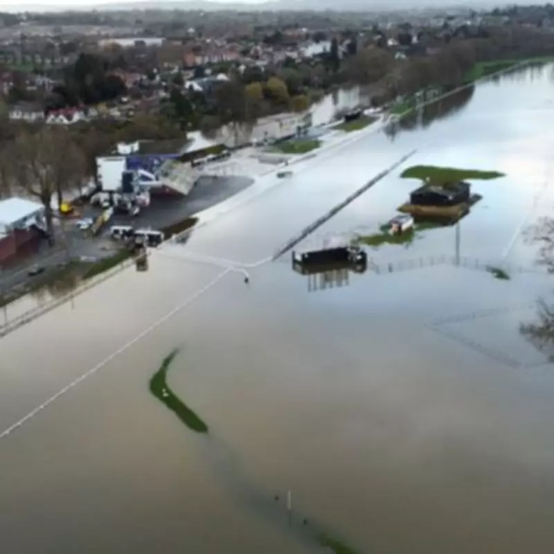
Recent Flooding Incidents and Impact
Recent flooding has already caused significant disruption across the UK. For example, a racecourse was under water in Worcester following flooding last week, and Worcestershire County Cricket Club was also submerged. These incidents underscore the real-world impact of the current weather conditions and the importance of heeding warnings.
The Environment Agency continues to monitor the situation closely, with flood duty managers working around the clock to protect communities. Despite efforts to safeguard properties, the risk remains high, and residents in affected areas are advised to take necessary precautions, such as avoiding travel if possible and staying informed through official channels.
As the week progresses, the weather is expected to remain volatile, with potential for further warnings. The public is encouraged to stay updated on the latest forecasts and alerts from the Met Office and Environment Agency to ensure safety during this period of heightened weather activity.


