
UK Braces for Extended Blizzard Conditions as Snow Maps Predict Widespread Freeze
Britain is preparing for a significant cold snap with newly released snow maps indicating the potential for five consecutive days of blizzard-like conditions across multiple regions. The latest long-range forecasts suggest a substantial temperature drop could sweep across the country from mid-February onward, bringing increased risks of snowfall and wintry hazards.
Geographic Impact and Timing Predictions
Weather models from WXCHARTS and other forecasting services show purple-shaded areas representing heavier snowfall coverage expanding across Scotland and northern England before potentially moving southward. By Tuesday, February 17, the freezing conditions are expected to reach as far south as the Midlands region, while southern England may experience drier but potentially wetter conditions instead.
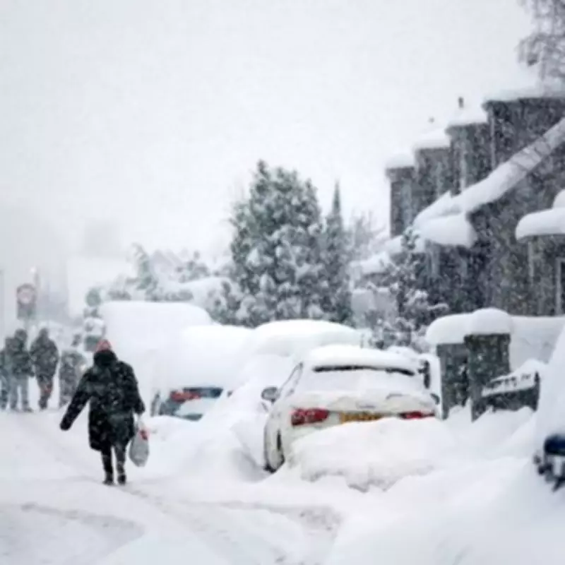
The Valentine's Day weekend could see the initial onset of this freezing weather pattern, with disruption already occurring this winter in northern England, Wales and Scotland where snow and freezing rain have created travel hazards. Some projections indicate widespread purple coverage across these regions in the coming weeks, though forecasters emphasize that exact timing and locations remain difficult to predict with certainty.

Forecasting Challenges and Model Scenarios
The Met Office has highlighted the particular difficulty of long-range snowfall predictions in Britain's temperate climate, where even minor temperature fluctuations can determine whether precipitation falls as rain or snow. Their latest assessment indicates: "Predominantly cyclonic patterns are expected to dominate the UK. The early part of this period could see colder conditions becoming established more widely for a time, bringing with it the likelihood of some snow."
In worst-case model scenarios presented by various forecasters, large swathes of the United Kingdom appear shaded purple - the typical mapping representation for heavier or more widespread snowfall - stretching from Scotland into parts of England and Wales. However, even if snow materializes, it may be patchy in certain areas with mixed precipitation including rain, sleet and hill snow likely dominating in northern regions.
Longer-Range Weather Patterns
Longer-range outlooks continue to point toward generally unsettled weather conditions overall, with low-pressure systems expected to bring rain, strong winds and occasional wintry spells rather than constant snowfall. The Met Office notes that milder and wetter weather may persist in far southern regions, while many parts could become somewhat milder due to increased westerly influences.
By the end of the forecast period, the track of Atlantic depressions may shift slightly northward compared to recent weeks, maintaining broadly unsettled conditions with further spells of rain and potentially strong winds. The weather service adds: "There remains the chance that colder conditions could linger towards the northeast" even as other regions experience temperature moderation.
Forecasters universally caution that snow predictions can change rapidly, and travelers should monitor updated forecasts as the potential blizzard period approaches. The combination of possible snow, ice and accompanying travel disruption risks necessitates preparation across affected regions as Britain faces this potential extended winter weather event.


