
Met Office Issues Snow Warnings as UK Temperatures Plunge Below Freezing
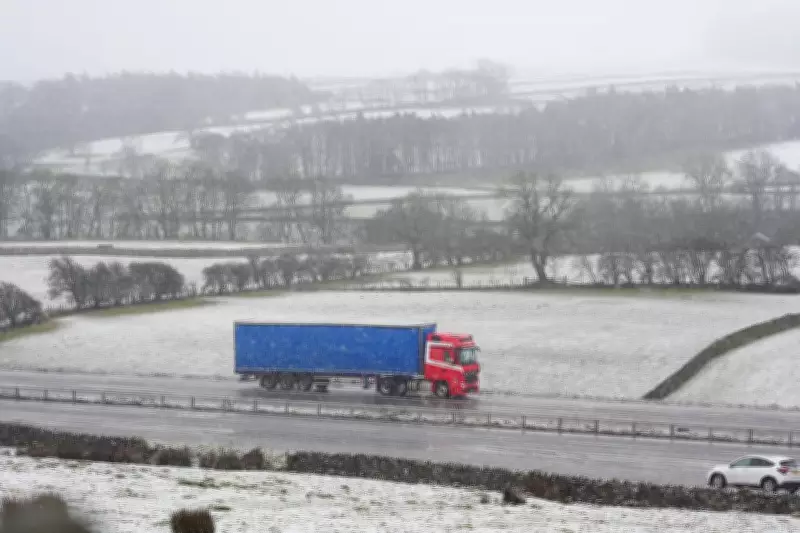
The Met Office has activated multiple yellow weather warnings for snow and ice across significant portions of the United Kingdom, with temperatures set to plummet below freezing in many areas. Scotland and northern England are expected to bear the brunt of the wintry conditions, which could bring up to 10 centimetres of snow and potential travel chaos.
Warnings and Forecast Details
Two separate yellow alerts have been issued, covering Scotland from 4pm on Thursday and extending to regions including the East Midlands, North East England, North West England, West Midlands, and Yorkshire and Humber from 7pm. Both warnings are scheduled to remain in effect until midday on Friday.
Chief forecaster Jason Kelly provided specific details, stating, "Any settling snow will mainly be confined to high ground. Locations above 200 metres in Scotland and northern England may see 2-5cm of snow, but those above 300 metres could experience double those amounts, up to 10 cm." He added that as precipitation clears, temperatures will fall rapidly under clear skies, leading to ice formation on untreated surfaces.

Health and Travel Impacts
In response to the forecasted sub-zero temperatures on Thursday and Friday, the UK Health Security Agency has issued a cold health alert. This alert will be active from 6am on Friday to 8am on Monday in the East Midlands, North East, North West, West Midlands, and Yorkshire and Humber regions.
The agency warned that the weather is likely to have minor impacts on health and social care services, including increased healthcare usage by vulnerable populations who face elevated risks. In Cumnock, East Ayrshire, temperatures could drop as low as -4°C on Friday night.
Travel disruption is anticipated, with roads and railways likely to be affected, potentially causing delays. The Met Office also cautioned about injuries from slips and falls on icy surfaces.
Broader Weather Context
This cold snap follows weeks of relentless rain across the UK, offering a brief respite from the wet conditions. Met Office spokesman Grahame Madge explained, "There is an Arctic Maritime airmass that will be moving south during this week, bringing a colder influence to the UK's weather. This colder spell is likely to be brief, as longer-range indications are from later in the weekend that the weather will be more dominated by Atlantic conditions."
Extended Forecast Outlook
Today: Rain in the north pushes southwards, with brighter skies developing across Scotland. Snow showers are expected in the northeast, while persistent rain affects Wales and southeast England with hill snow across northern England. Sunny spells will appear in the southwest, with colder conditions spreading north.
Tonight: Rain and hill snow will move southwards slowly, with clearer spells developing in the north. Widespread frost and icy patches will form. Variable cloud cover in the south may bring occasional heavy showers.
Friday: Rain continues to shift southwards, with Northern Ireland and Scotland seeing some sunshine. Snow showers are likely around coastal areas. Cloudy and wet conditions will persist across the south before clearing later.
Saturday to Monday Outlook: Bright skies with sunny spells on Saturday, though it will feel significantly colder than recent days. Conditions will turn wetter on Sunday, with widespread snow probable across the north. Unsettled weather is expected to continue into next week.


