
Meteorological data indicates that a substantial winter storm system could sweep across the United Kingdom in the coming days, with advanced forecasting models suggesting up to 90 percent of the nation may experience snowfall. The impending weather event has the potential to disrupt travel and daily life, particularly in major urban centres.
Timeline and Projected Impact
According to the GFS weather model, the initial flurries are expected to arrive in the early hours of February 15. The data suggests snow could first move across southern regions around 3am, potentially affecting cities including London and Birmingham, as well as parts of central England, Wales, and Northern Ireland.
By midday on February 15, intense snowfall is projected to be falling across a significant portion of England. Scotland may also begin to see snow around this time. The system is then forecast to spread northward throughout the day.

Regional Snowfall Projections
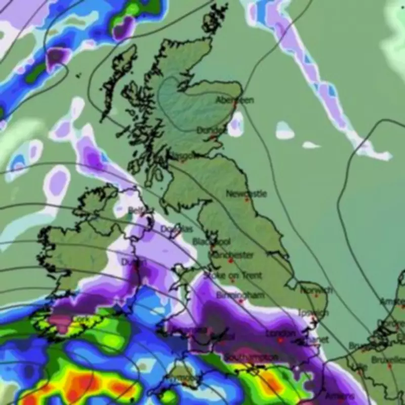
Snow depth charts present a varied picture of potential accumulation across the country:
- The Scottish Highlands could see the most substantial accumulation, with forecasts suggesting up to 33 centimetres (approximately 13 inches).
- Parts of South Wales may receive around 23 centimetres (nine inches).
- Areas of southern England could see accumulations of about 14 centimetres (5.5 inches).
By midnight on February 15, northern England regions including Greater Manchester and Yorkshire are expected to be in the firing line. The following day, February 16, could bring heavy snow to southern Scotland and north-eastern England.
Official Forecasts and Warnings
The Met Office has indicated that wintry hazards could impact southern regions later in February. Their forecast for the period February 7 to 16 states that frontal systems approaching the UK may stall against blocking high pressure to the north and northeast.
"This will result in further spells of rain at times, falling in areas already sensitive to flooding," the Met Office notes. "As these bands of rain spread northwards, some snow will be possible in northern England and Scotland, mainly over higher ground, as they encounter colder air."
The national weather agency anticipates a subtle shift southwards of low-pressure areas during the second week of February, which may allow colder air to spread across larger parts of the UK, including the south, bringing an increased risk of wintry hazards.
Contrasting Forecast Perspectives
While some models predict widespread snow, BBC Weather suggests a major snow event remains unlikely for the period February 9 to 15. Their forecast describes a colder setup developing with high pressure building from the north and northwest.
"This will provide more resistance to fronts and milder air trying to edge northwards, and colder air should win out, with temperatures dropping below average right across the UK," the BBC forecast states. "Even southern England could see temperatures at least slightly below seasonal values."
The BBC anticipates changeable conditions becoming somewhat drier overall, especially later in the week, with occasional showery outbreaks that may turn wintry over higher ground and down to lower levels in some northern regions.
Potential Nationwide Coverage
Snow coverage charts for February 17 show the vast majority of the UK shaded in purple, indicating that almost every region could see some snow settled on the ground following this wintry weather blast. This visual representation supports the prediction that approximately 90 percent of the country may be affected.
The combination of brisk easterly winds and below-average temperatures could create particularly cold conditions, especially along eastern coasts. Drier and calmer interludes between weather systems may lead to sharp overnight frosts and risks of fog formation.
As conflicting forecasts emerge between different meteorological models, residents across the UK are advised to stay updated with the latest weather warnings and prepare for potential winter weather disruptions in the coming weeks.


