
Valentine's Day Blizzard Set to Bury UK Cities Under Inches of Snow
Advanced meteorological forecasting maps indicate a significant winter storm is poised to sweep across the United Kingdom this weekend, delivering several inches of snowfall over a concentrated twelve-hour period. The system is expected to initiate on the evening of Valentine's Day, potentially disrupting travel and daily activities nationwide.
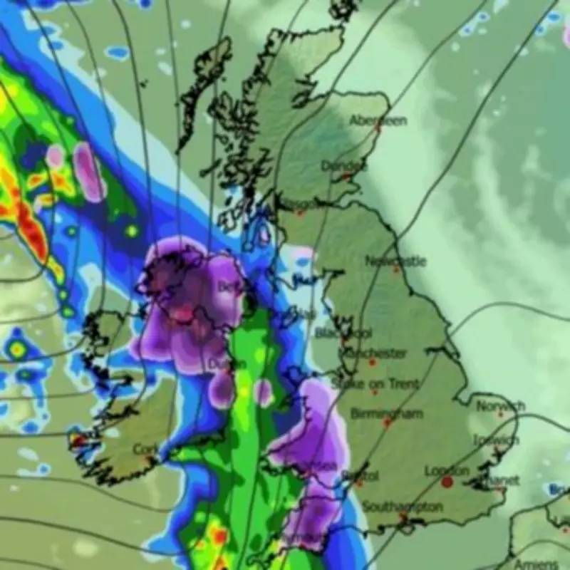
Storm Timeline and Initial Impact Zones
Weather modelling data from the ECMWF suggests the storm will first make landfall from the Atlantic Ocean on Saturday evening around 9pm. Initial snowfall is projected for Northern Ireland, Wales, and the southwestern regions of England. Cities such as Belfast, Swansea, and Plymouth are likely to be among the first areas affected by the accumulating snow.
As the night progresses into the early hours of Sunday, the system is forecast to drift eastward, engulfing a substantial portion of England and Scotland. By midnight on Valentine's Day, meteorological maps show snow falling across parts of the Midlands, the northwest of England, and western Scotland. Major urban centres including Birmingham, Manchester, and Liverpool could all experience flurries around this time.

Peak Intensity and Accumulation Projections
The most intense snowfall is anticipated over the North Pennines by approximately 6am on Sunday. Concurrently, Yorkshire and the northeast of England are likely to see snow, with almost all of Scotland also facing flurries. The storm is then predicted to gradually subside as Sunday progresses.
By 9am, while some light snow may persist along the east coast and in northern Scotland, coverage maps indicate extensive areas of Northern Ireland, Wales, the Midlands, and northern England will have snow settled on the ground. Snow depth charts project significant accumulations, with mountainous regions in Scotland potentially seeing up to 176 centimetres (69 inches). The North Pennines could receive around 12 centimetres (five inches), while Wales and Northern Ireland might both see approximately 4 centimetres (1.5 inches).
Official Weather Warnings and Extended Forecast
The Met Office has issued a warning, stating that "widespread snow" is expected across the northern parts of the UK this weekend. Their forecast for Saturday indicates bright skies with sunny spells but a noticeable drop in temperature compared to recent days. Conditions are predicted to turn wetter on Sunday with the likelihood of extensive snow coverage in northern regions, leading to an unsettled pattern into the following week.
BBC Weather adds that further disruptive weather, including additional snowfall and potential flooding, could follow in the week ahead. Their forecast suggests "broadly south-westerly wind flows" may develop, initially bringing milder conditions to southern areas while Scotland remains chillier. This Atlantic-influenced weather pattern is expected to bring periods of wet and windy weather as frontal systems cross the UK, with above-average rainfall amounts increasing the risk of localised flooding, particularly in southern and southwestern regions and South Wales.
There is also a possibility of snow on the colder leading edges of these rain bands, especially over higher ground in northern areas. A signal exists for high pressure to build over the eastern Atlantic between weather systems, which could deliver brighter but chillier interludes with some wintry showers on north to north-westerly winds.


