
The Met Office has officially designated the incoming weather system as Storm Chandra, issuing a fresh series of weather warnings that span much of the United Kingdom. Forecasters are predicting a potent mix of strong winds, heavy rainfall, and significant snowfall, particularly from Monday night into Tuesday, with substantial disruptions anticipated.
Widespread Hazards and Disruption Forecast
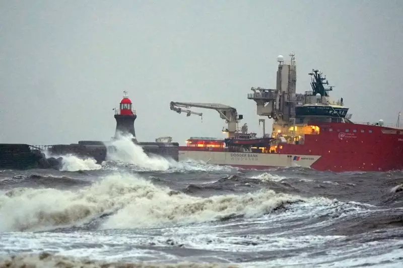
Meteorologists have warned that flooding and travel disruption are highly likely in numerous locations as Storm Chandra sweeps across the country. The storm is expected to bring a complex array of weather hazards, affecting both southern and northern regions with varying intensity.
Amber and Yellow Warnings in Force
Several weather warnings have been activated by the Met Office in response to the approaching storm. Amber warnings, indicating a heightened level of danger, have been issued for south-west England due to heavy rain and for the eastern coast of Northern Ireland because of strong winds.

Additionally, less severe yellow warnings are currently in place for the entirety of Northern Ireland and a more extensive area of south-west England. Parts of northern England and Scotland are also under yellow alerts, reflecting the broad geographic impact of Storm Chandra.
Specific Regional Impacts Detailed
Met Office chief forecaster Paul Gundersen provided detailed insights into the expected conditions. He stated, "Initially strong winds will impact the Isles of Scilly, western Cornwall and south-west Wales which are still vulnerable after Storm Goretti, gusts of 70 to 80mph are possible here."
Gundersen further explained, "Heavy rain is an additional hazard as it falls on saturated ground in Dorset and southern parts of Devon, Somerset and Cornwall." This combination of wind and rain raises serious concerns about localised flooding and potential damage to infrastructure.
Snow Accumulation in Northern Areas
As Storm Chandra moves northward and interacts with colder air masses, snow becomes a prominent hazard. Forecasters anticipate that 10-20cm of snow could accumulate over higher ground in specific regions, including the Pennines, southern Scotland, and the Highlands.
This significant snowfall is likely to lead to treacherous travel conditions, possible road closures, and disruptions to public transport services in affected areas.
Public Advisory and Safety Recommendations
In light of the complex and hazardous weather pattern, the Met Office is urging the public to remain vigilant. Gundersen emphasised, "With a complex spell of weather, its important people stay up to date with the forecast and any warnings in your area."
Residents are advised to monitor local weather updates regularly, prepare for potential power outages, and avoid unnecessary travel during the peak of the storm. Emergency services are on standby to respond to incidents as Storm Chandra unfolds across the UK.


