Britain is braced for a potentially severe bout of winter weather, with new forecasts indicating staggering snowfalls of up to 17 inches could blanket several towns and cities in early January.
Widespread Snow Event Predicted for January 7
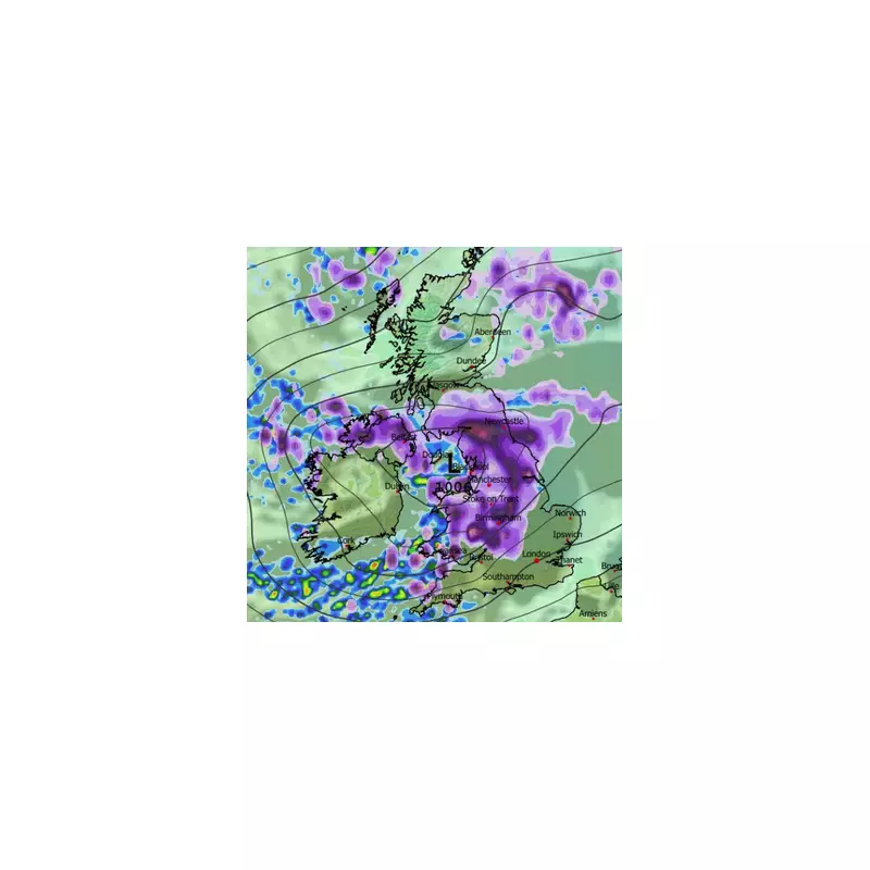
Shocking data from the advanced ECMWF weather model shows a significant snow event sweeping across the UK on Tuesday, January 7. The system is expected to engulf northern England, the Midlands, and Wales around midday, with snowfall rates potentially exceeding one inch per hour in the most intense flurries.
By 6pm on the same day, the snow is forecast to push into southern England. London appears to be directly in the firing line, while the south coast could experience an astonishing accumulation rate of around four inches per hour according to the maps.

Heavy Accumulations and Depth Forecast
The snow is expected to continue intermittently, with further flurries possible around midnight on January 7 across East Anglia, the south-east, the Midlands, North Wales, northern England, and parts of southern Scotland. However, it is the projected snow depths for later in the week that are truly astounding.
By midday on Thursday, January 9, the ECMWF model indicates that some areas could be buried under immense accumulations. The data suggests up to 44cm (17 inches) of snow could settle on the ground in parts of Merseyside, potentially bringing Widnes, St Helens, and areas of Liverpool to a standstill.
Other regions facing major accumulations include:
- 40cm (16 inches) over the Pennines.
- 38cm (15 inches) in the far north of Scotland.
- 40cm in some parts of Wales.
Major urban centres are not immune. Cities including London and Birmingham can expect between 6cm and 10cm of snow, which would cause significant travel disruption.
Contrasting Forecasts from the BBC
In contrast to the dramatic ECMWF model, forecasters at BBC Weather offer a more cautious outlook for the start of January. While acknowledging the possibility of snow, the BBC's forecast for January 5 to 11 suggests it is more likely to be confined to higher ground, most notably across the Scottish Highlands.
The BBC anticipates that frontal systems moving in from the Atlantic will bring increased precipitation, but for most areas this will fall as rain. They note a drier spell is possible initially, but highlight uncertainty in the pattern, with a chance that high pressure could build and lead to a much drier period overall.
The disparity between these forecasts underscores the inherent uncertainty in long-range weather modelling. The public is advised to monitor official updates from the Met Office as the potential event draws nearer, and to prepare for possible significant disruption to travel and services in the first full week of January.