Millions of Australians are bracing for a severe and dangerous weekend of weather as a powerful low-pressure system threatens to unleash torrential downpours, destructive winds, and flash flooding along the eastern seaboard.
Severe Warnings Issued for NSW Coast
The Bureau of Meteorology has issued a severe warning for heavy rainfall and damaging winds for the NSW Illawarra, South Coast, and Southern Tablelands districts. A low-pressure system developing off the coast is expected to drive the deluge, with up to 80mm of rain forecast for parts of southern NSW on Friday alone.
The intense rainfall is predicted to move into the Sydney metropolitan area overnight, where a staggering 100mm could fall across the weekend, marking the wettest period of the summer so far. Conditions are set to deteriorate sharply from Friday afternoon, particularly in the Shoalhaven and Illawarra regions.

Destructive Winds and Hazardous Seas
Alongside the flooding rain, the system will pack a powerful punch from the wind. Peak gusts of up to 100 km/h are forecast along the coastline, raising the risk of damage and power outages. Bureau of Meteorology forecaster Angus Hines warned residents to prepare for damaging wind gusts and persistent, heavy rain.
A hazardous surf warning has been extended from the Sydney coast down to Eden, with authorities urging people to avoid dangerous water activities. The treacherous conditions are also expected to cause significant coastal erosion from Cronulla in Sydney's south down to Batemans Bay.
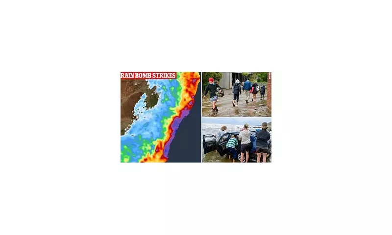
Tourists Urged to Rethink Plans as Clean-Up Continues
Emergency services have issued urgent appeals for tourists holidaying in the affected regions to reconsider their plans and heed official advice. The warning comes just hours after record-breaking flash floods wreaked havoc in Victoria, washing away vehicles and inundating campgrounds along the Great Ocean Road.
NSW SES Superintendent Dallas Burnes emphasised the risks for campers, stating, "We are asking people to be particularly cautious if they are camping near creeks, rivers or lakes, as water levels can rise quickly and cut off road access. Heavy rain is forecast to continue for several days in some areas, and campers may become isolated if they do not leave ahead of the severe weather."
A major clean-up is already underway along Victoria's south-west coast after an inland downpour on Thursday afternoon swelled the Wye, Kennett, and Cumberland rivers. Approximately 178mm fell in just six hours, forcing the closure of the Great Ocean Road and leaving a trail of destruction.
Nationwide Weather Extremes
The wild conditions are not confined to the south-east. In Queensland, parts of the rain-ravaged north and centre remain on flood watch, and another weather system forming off the coast has a high chance of developing into a severe tropical cyclone early next week. Further south, severe thunderstorms are forecast for the eastern Darling Downs and Granite Belt.
In stark contrast, Melbourne is set to swelter through highs of 28C to 29C for the start of the Australian Open, while Adelaide and Perth will enjoy dry and sunny conditions. Darwin, however, could see up to 160mm of rain over the weekend.
Despite the disruption, the soaking rains have been welcomed in some areas of the South Coast which had experienced significant rainfall deficiencies over the preceding four months. Weatherzone reported that January had been virtually bone dry before the recent deluge, with Brogo Dam near Bega recording more than 115.8mm within 24 hours.