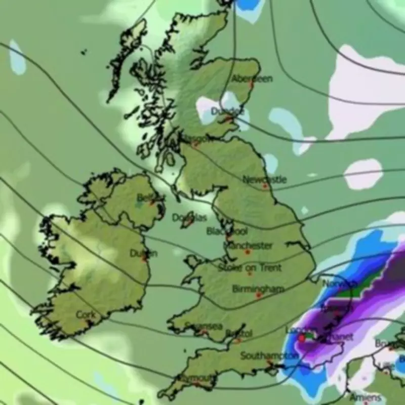
Major Snowstorm Threatens to Paralyse UK Cities
Advanced meteorological modelling indicates that a significant Beast from the East weather system could be mere days away from delivering substantial snowfall to numerous major urban centres across the United Kingdom. The Global Forecast System (GFS) weather model charts a concerning path for a powerful winter storm originating from the east, with initial impacts expected to be felt across the south-east and East Anglia regions.
Timeline of the Impending Winter Blast
According to the latest predictive maps, the first flurries are projected to reach the capital, with London anticipated to see snowfall commencing around 6pm on February 5th. The system is then forecast to intensify and spread rapidly, with maps indicating widespread snow falling across eastern, central, and southern England by 9pm on the same evening. The wintry conditions are expected to continue their advance overnight, reaching northern Scotland and Wales by 6am on Thursday, February 6th.
Urban Centres in the Firing Line
This developing blizzard threatens to disrupt several of the nation's most populous cities. Weather modelling suggests that, alongside London, major metropolitan areas including Birmingham, Cardiff, Manchester, Newcastle, and Edinburgh could all experience significant snowfall. The intensity is forecast to peak during the evening of February 6th, with heavy flurries predicted over Birmingham and the Peak District. Furthermore, intense snowfall is expected along the England-Wales border on February 7th, potentially causing major travel disruption.
Projected Snow Accumulation and Coverage
Snow coverage maps reveal the extensive reach of this impending wintry blast, indicating that settling snow is likely across southern England, the Midlands, Wales, northern England, and most of Scotland. The data suggests the potential for substantial accumulations of up to 20 centimetres in the Scottish Highlands. While accumulations elsewhere are projected to be less severe, northern England and Wales could still see up to 5cm of snow settling, enough to cause significant localised problems.
Official Meteorological Outlook and Warnings
The Met Office has highlighted an increased risk of wintry hazards as the UK moves into February. Its forecast for the period of February 4th to 13th notes that frontal systems are likely to approach but may stall against blocking high pressure to the north and northeast. This scenario could lead to further spells of rain, with a heightened risk of snow on high ground in northern England and Scotland as precipitation encounters colder air.
The national weather service anticipates a subtle shift in pressure systems during the second week of February, which may allow colder air to spread across the northern UK, bringing an increased risk of snow and ice for a time. Looking further ahead into late February, the Met Office indicates that a south-shifted jet stream is likely to persist, steering further areas of low pressure towards the UK. This pattern suggests the potential for additional wet, windy, and potentially wintry conditions, with hill snow remaining possible across northern parts as systems meet colder air masses.


