
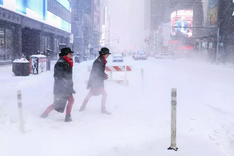
Meteorologists are closely monitoring a developing weather system that could escalate into a powerful bomb cyclone, threatening to deliver another substantial snowstorm to the East Coast of the United States this weekend. The forecast indicates potential for significant snowfall accumulation, particularly from the Carolinas northeastward to New York City and into New England, following last weekend's disruptive winter event.
Storm Development and Potential Impacts
According to AccuWeather Meteorologist Tyler Roys, the storm is expected to form off the Carolina coast on Saturday before tracking northeastward and undergoing rapid intensification. This process of quick central pressure drop qualifies the system as a potential "bomb cyclone," creating stronger winds and more severe weather conditions than typical winter storms.
The forecast suggests areas still recovering from last weekend's major snowstorm, including New York City, will likely see additional accumulation beginning late Saturday and continuing into early Sunday morning. The Weather Channel indicates coastal areas like Wilmington and Virginia Beach may also experience snowfall as the system moves up the coastline.

Snowfall Distribution and Regional Variations
Meteorological analysis reveals important geographical variations in expected snowfall amounts. Higher accumulations of three inches or more are anticipated east of New York City, particularly on Long Island and across New England regions including Boston. Meanwhile, areas west of the New York metropolitan area, such as Philadelphia, will likely receive minimal snowfall, providing some relief following last weekend's severe weather.
"New York City metro areas are looking at one to three inches, and if you head west of New York City, the chances of seeing anything closer to three inches at this moment looks to be on the lower side," Roys explained, highlighting the uneven distribution pattern.
Timing and Forecast Uncertainty
Current projections indicate snow will reach New York City either Saturday night or early Sunday morning, potentially lasting through the night. However, forecasters emphasize that the storm's precise path remains subject to change, which could significantly alter snowfall predictions for affected regions.
"Any slight shift in the tracks can mean more or less snow than what we're forecasting," Roys cautioned, underscoring the inherent uncertainty in weather prediction models for rapidly developing systems.
Broader Context and Safety Concerns
This potential weather event follows last weekend's devastating winter storm that affected twenty states, dropping over a foot of snow in some areas and leaving more than one million energy customers without power. The previous system resulted in at least sixty-two fatalities across the United States, including five cold-related deaths in New York City and three young brothers in Texas who died after falling through an icy pond.
Beyond immediate snowfall concerns, forecasters warn that bitter cold temperatures will likely persist even after the storm passes, preventing existing snow from melting and creating hazardous conditions. The combination of new snowfall and lingering cold could extend recovery efforts from the previous weekend's severe weather event.
Residents across the East Coast are advised to monitor updated forecasts closely and prepare for potential power outages, travel disruptions, and dangerous wind conditions as the weekend approaches and this weather system develops.


