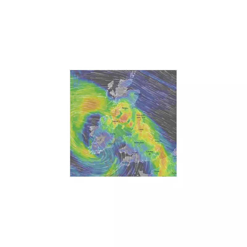
Storm Chandra Live Weather Map Tracker as Met Office Predicts 8 Inches of Snow
This interactive live weather tracking map reveals where Storm Chandra will strike next, with heavy rain, high winds, and significant snow anticipated across the United Kingdom in the coming hours. The storm is currently swirling around the nation, bringing severe disruption expected to last well into the evening.
Widespread Weather Warnings and Expected Impacts
Storm Chandra continues to barrel across the UK from the southwest, delivering powerful winds, torrential rain, and snow. The Met Office has issued a stark warning that almost a month's worth of rain is set to fall in just a few hours, with some areas bracing for up to 80mm on higher ground. Fierce winds of up to 80mph are forecast, alongside heavy snow accumulations in northern regions.
Weather warnings are in place across England, Scotland, Wales, and Northern Ireland. An amber warning for rain covers south-west England from Bournemouth to St Austell. The entire south coast, the south-east, and South Wales remain under three separate yellow warnings. Further north, from Derbyshire to the Scottish borders, up to eight inches of snow could accumulate on higher ground.
Travel Chaos and Significant Disruptions
The storm has already caused considerable travel chaos this morning, with roads and bridges closed, fallen trees blocking routes, and cancelled flights and trains disrupting commuters. Over 100 flood warnings have been issued by the Environment Agency, including one 'danger to life' severe flood warning for Ottery St. Mary in Devon. A further 200 flood alerts are active, indicating flooding is possible.
Additionally, almost 300 schools have been confirmed as closed due to the severe weather conditions. The Scottish Avalanche Information Service has issued six avalanche warnings as unstable snow builds on high ground, threatening areas below.
Met Office Forecast and Official Statements
A Met Office forecast states: "Storm Chandra will bring persistent rain, heavy at times before steadily clearing northeastwards on Tuesday morning. 30-50 mm rainfall is likely widely, with 60-80 mm across some higher ground, especially south Dartmoor. Falling on saturated ground, this is likely to lead to flooding and disruption, particularly on Tuesday morning. Strong southeasterly winds are also expected."
The forecast adds: "Storm Chandra will bring a period of strong easterly or southeasterly winds to southwest Scotland during Tuesday. Gusts of 50-60 mph are likely, especially around exposed coasts. Large waves may bring additional impacts to some coastal areas. Impacts may be higher than normal from winds of this magnitude because of the unusual direction as well as combining with spells of heavy rain."
Met Office Chief Forecaster, Paul Gundersen, emphasised: "As Chandra interacts with colder air further north snow becomes a hazard, with 10-20cm of snow possibly accumulating over higher ground in the Pennines, southern Scotland and the Highlands. With a complex spell of weather, it's important people stay up to date with the forecast and any warnings in your area."
Residents are urged to monitor local updates and travel advisories closely as Storm Chandra continues its path across the UK.


