
Widespread Flood Alerts Issued Across the UK Following Prolonged Rainfall
The United Kingdom is bracing for significant flooding and travel disruptions as hundreds of official warnings remain in place after weeks of relentless rain. The Environment Agency has activated 89 flood warnings, indicating that flooding is expected, alongside 223 alerts where flooding is possible, primarily across England.
Regional Impact and Groundwater Concerns
Most warnings are concentrated in the south-west and the Midlands, with Scotland also reporting four active flood warnings. The Environment Agency predicts ongoing flooding from groundwater over the next five days in Dorset, Wiltshire, Hampshire, and West Sussex. River flooding is probable in Somerset, with local river flooding likely along the River Severn for five days and the Rivers Trent and Soar until Tuesday.
Properties are at high risk of flooding, and travel services are anticipated to experience considerable delays, compounding the challenges for commuters and residents.

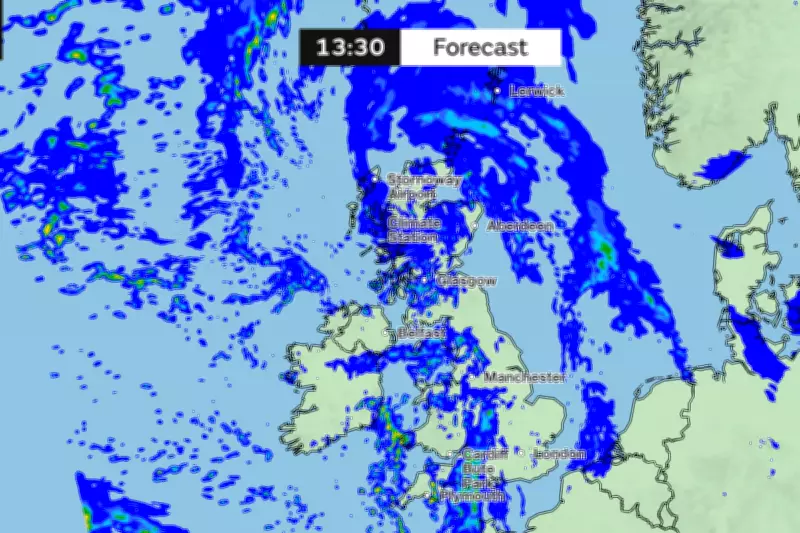
Met Office Weather Warning and Rainfall Statistics
The Met Office has issued a yellow weather warning for rain, effective from 12 noon until 23:59 on Monday. This alert covers parts of London, South East England, South West England, and Wales. Forecasters warn that heavy rain during Monday afternoon and evening could lead to flooding, travel disruption, and potential interruptions to power supplies and other essential services.
"Bands of rain and heavy showers will move east across southern parts of England and Wales during Monday afternoon and evening," the Met Office stated. "10-15 mm of rain is likely fairly widely with 20-30 mm in some places exposed to the strong south to southeasterly winds."
Unprecedented Wet Start to the Year
This warning comes amid an exceptionally wet start to 2026, with rain recorded somewhere in the UK every day so far, totaling 36 consecutive days. South-west England and South Wales have experienced 50 per cent more rainfall than usual, according to Met Office data released on Thursday.
Met Office spokesperson Stephen Dixon commented, "Rain has been reported somewhere in the network every day of the year so far. While amounts are trivial on some days, and some areas will have seen dry days, the UK has seen a wet start to the year, particularly in Northern Ireland and southern England."
He attributed the persistent wet conditions to "a succession of fronts or low pressure systems arriving from the west, bringing heavy rain at times, as well as damaging winds for some." Dixon added that there is "little sign of a let-up in the current forecast, with further unsettled weather in the coming days and over the weekend."
Broader Flooding Risks and Historical Context
Local inland flooding is likely for the South and West of England on Monday, possibly extending into Tuesday. More widely, local inland flooding is possible from Sunday through Wednesday, according to the Environment Agency. This situation follows a turbulent January, during which three named storms struck the UK, causing widespread floods and travel disruptions.
The cumulative effect of continuous rainfall and successive weather systems underscores the severity of the current flood threat, with authorities urging the public to stay informed and take necessary precautions.


