
The Met Office has pinpointed twenty-six specific areas across the United Kingdom that could experience snowfall today, as a band of wintry weather moves northwards. Several weather warnings for snow, ice, and wind remain in effect this week, with the national forecaster indicating that further flurries are likely in certain regions.
Regions and Areas Facing Snow Today
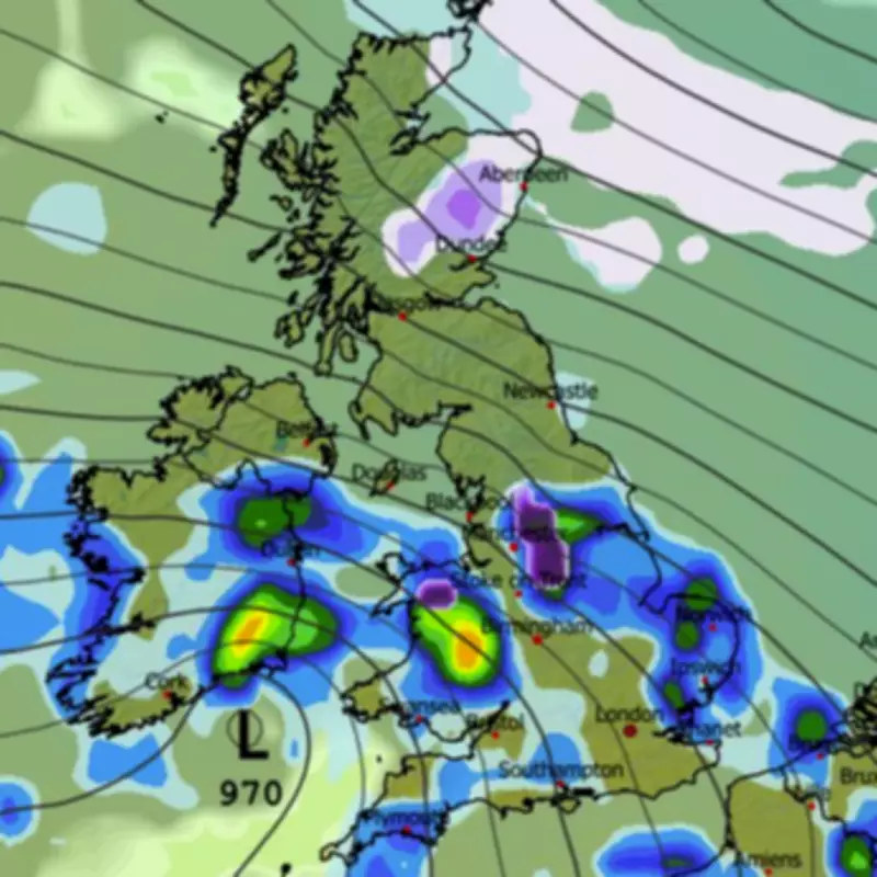
According to the latest Met Office forecast, rain is expected to advance northwards throughout the day, becoming heavy in places. This precipitation is then likely to turn to snow over three key regions: North Wales, the Pennines, and the Scottish mountains. The forecast explicitly states: “Rain moves northwards through the day, turning heavy in places and again, possible snow across north Wales, the Pennines and Scottish mountains. Winds staying strong in the north. Average temperatures.”
Detailed List of Affected Areas
The regions of North Wales, the Pennines, and the Scottish mountains encompass a total of twenty-six counties or council areas. The specific locations identified by the Met Office are as follows:

North Wales:
- Isle of Anglesey
- Gwynedd
- Conwy
- Denbighshire
- Flintshire
- Wrexham
The Pennines:
- Derbyshire
- Staffordshire
- Greater Manchester
- Cheshire
- Lancashire
- West Yorkshire
- South Yorkshire
- North Yorkshire
- Cumbria
- Northumberland
Scottish Mountains:
- Highland
- Aberdeenshire
- Perth and Kinross
- Argyll and Bute
- Angus
- Moray
- Dumfries and Galloway
- Scottish Borders
- South Lanarkshire
- East Ayrshire
Extended Forecast and Further Warnings
The Met Office has also provided guidance for the coming weeks, indicating that more snow could arrive across parts of England and Scotland later this month. In its forecast for the period from February 9 to 18, the agency notes: “Rainfall amounts will probably be highest in parts of the west, including across areas already sensitive to flooding. As these bands of rain spread northwards, snow is possible across northern England and Scotland, mainly over high ground. Strong winds could develop in places, especially coasts. Temperatures will probably be close to normal overall, with any cold conditions more likely in the north.”
Looking further ahead to February 19 through March 5, the Met Office suggests that changeable conditions will persist. The forecast adds: “Changeable conditions are expected across the UK during this period. Low pressure systems will probably dominate, meaning showers or longer spells of rain, heavy at times, for much of the UK and some hill snow in the north. Periods of strong wind are also possible, especially around coasts. Temperatures will likely be close to average or slightly above overall.”
Residents in the affected areas are advised to stay updated with the latest Met Office warnings and prepare for potential travel disruptions and hazardous conditions due to snow and ice.


