A significant earthquake measuring 7.4 on the magnitude scale has struck off the coast of Indonesia, as confirmed by the United States Geological Survey (USGS). The seismic event occurred on Thursday morning, with the USGS reporting it struck at 9.48am Australian Eastern Daylight Saving Time (AEDST).
Details of the Earthquake
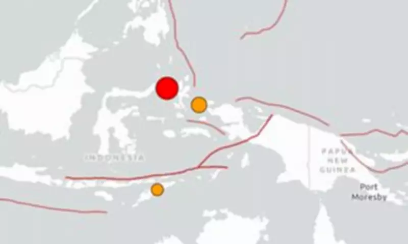
According to the USGS, the earthquake had a depth of 35 kilometres, indicating a shallow event that can often lead to more intense shaking at the surface. The epicentre was precisely located 127 kilometres west northwest of Ternate, Indonesia, placing it in a region known for seismic activity due to tectonic plate boundaries.
Tsunami Warnings Issued
The Pacific Tsunami Warning Centre has issued advisories for potential tsunami threats following the quake. These warnings are specifically directed at Indonesia, the Philippines, and Malaysia, urging coastal communities to remain vigilant and follow emergency protocols. Authorities are closely monitoring sea levels for any signs of tsunami waves, which could pose significant risks to low-lying areas.

Regional Impact and Response
Indonesia, situated along the Pacific Ring of Fire, is no stranger to earthquakes and tsunamis, with past events causing widespread damage and loss of life. Emergency services in the affected countries are likely mobilising to assess the situation and provide aid if necessary. Residents are advised to stay informed through official channels and prepare for possible evacuations.
As assessments continue, more information is expected to emerge regarding the earthquake's impact on infrastructure, potential casualties, and the effectiveness of early warning systems. The international community is watching closely, with organisations like the USGS providing ongoing updates to aid in disaster response efforts.