Advanced weather forecasting models are predicting a significant and prolonged winter storm that will impact every region of the United Kingdom over six consecutive days. The system is expected to bring substantial snowfall, with some areas facing accumulations of up to 16 inches, alongside heavy rainfall that will disrupt daily life for millions of residents.
Detailed Timeline of the Incoming Storm
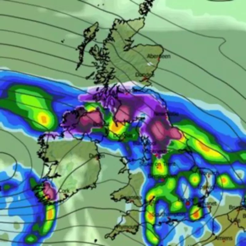
The Global Forecast System (GFS) weather model indicates that the first wave of snow will arrive in the early hours of April 7. At approximately 3am, precipitation will begin across Northern Ireland, southern Scotland, and northern England, while heavy rain showers engulf the remainder of England and parts of Wales.
Subsequent Days of Wintry Weather
On April 8, further snowfall is anticipated, with maps showing it spreading across most of Scotland and sections of the Midlands around 3am. Concurrently, rain is forecast for South Wales, the Midlands, and eastern England. By midday on April 9, a distinct band of snow is projected to stretch across southern England, potentially affecting London and South Wales, with additional flurries in northern England and Scotland.

The storm's intensity continues on April 10, with light snow flurries expected along the entire length of the UK at midday. Cities from Edinburgh and Newcastle to Manchester and Devon are likely to experience impacts. Scattered snow persists on April 11, followed by heavy flurries on April 12 targeting Northern Ireland, Wales, and Gloucestershire around 6am, accompanied by rain in south-west England.
Accumulation and Ground Coverage Predictions
Snow is expected to settle widely during this period, with coverage maps for April 10 showing accumulation on the ground in southern England, Wales, the Midlands, northern England, and Scotland. The heaviest accumulations are forecast for Scotland, where data suggests hills could receive up to 41 centimetres, equivalent to 16 inches, of snow.
Official Forecasts from Meteorological Agencies
The Met Office has indicated that snow could fall over hills in northern areas imminently. Looking ahead to early April, the national weather agency notes a chance of "some overnight frost" but expects temperatures to remain "near to or slightly above average." Their forecast for April 3 to April 12 describes a likely northwest to southeast split, with the northwest experiencing more unsettled conditions due to low pressure systems bringing strong winds and rain, while the southeast remains drier under high pressure influence.
BBC Weather adds that from April 6 to April 12, a blocked pattern with slow-moving high pressure east of the UK and low pressure in the central Atlantic should result in south-easterly to south-westerly flows. This setup is expected to bring above-average April temperatures and generally dry weather, though overnight fog and slight frost are possible in susceptible spots.
This extensive weather event underscores the variability of spring conditions in the UK, with residents advised to prepare for significant disruptions due to snow and rain across all regions.