A sharp and sudden cold snap is set to grip the UK, with parts of the country bracing for a dramatic nine-degree temperature drop within just 24 hours. The Met Office warns that widespread frost will form overnight, while a separate yellow warning for rain has been issued for southwest England and south Wales.
Sudden Chill Brings Widespread Frost Risk
Forecasters predict a significant shift in conditions from Tuesday into Wednesday, with a mass of chilly winter air sweeping across Britain. Temperatures are expected to tumble, making Wednesday night markedly colder than the previous one.
In southern England, the mercury is forecast to dip below -1C, while central areas will hover around freezing. This abrupt change means a high risk of widespread frost, particularly in rural regions, with drivers likely needing to scrape ice from their windscreens on Wednesday morning.
Met Office forecaster Annie Shuttleworth highlighted the stark contrast, stating: "You can see particularly across central areas of England there's a good nine-degree difference in the two nights." She noted that while Tuesday would bring some sunshine, the weather would remain "relatively unsettled" for much of the week.
North-South Divide and Snow Predictions
While the south and central UK shiver, northern areas are expected to stay milder overnight. Ayrshire in Scotland could see temperatures peak at around 6C in the early hours, with other northern regions around 3C.
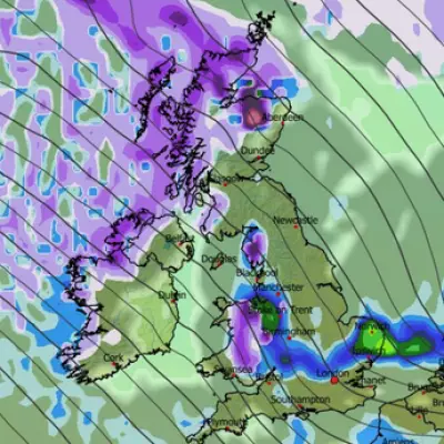
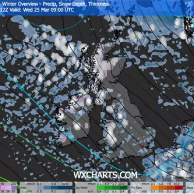
Looking further ahead, weather expert James Madden from Exacta Weather has predicted that the incoming cold spell could bring wintry conditions to higher ground. He forecasts potential snow across parts of the north and Scotland from Wednesday through to Friday.
Yellow Rain Warning for Southwest
Alongside the cold, a separate weather hazard is on the horizon. The Met Office has issued a yellow weather warning for rain covering southwest England and south Wales for Wednesday.
The alert warns that persistent and heavy downpours, especially over high ground, could cause travel disruption and flooding. This is due to the ground already being saturated from recent wet weather.
The warning states that 15-25mm of rain is expected widely, with 40-60mm possible on the high ground of Dartmoor and the hills of south Wales.
Detailed Forecast for the Coming Days
Tuesday: Any patchy rain in eastern England will clear through the morning. For most, it will be a dry and bright day, though feeling noticeably colder. Blustery showers are likely in northwest Scotland.
Wednesday to Friday Outlook: Conditions will turn wet and windy again from Wednesday, lingering into Thursday. Friday should be drier and brighter for many, though with a scattering of showers. Temperatures will be near average for December, with the far south staying relatively mild.


