Britain is preparing for a wintry and unsettled Easter weekend as meteorological maps reveal a dramatic 400-mile wall of rain set to sweep across the country, followed by significant snowfall on Easter Sunday. The latest forecasts indicate that coastal areas will bear the brunt of the heavy precipitation, with several millimetres of rain per hour expected from early morning through late night.
Detailed Forecast for the Easter Period
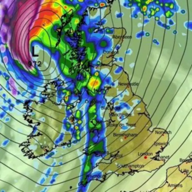
According to weather maps generated by WXcharts using MetDesk data on March 31, a vicious system of rain is scheduled to arrive in the late hours of Saturday, April 4. This extensive weather front will pour inches of rain over several hours, drenching a staggering 400-mile stretch from Edinburgh in Scotland to Dorset in South West England. The precipitation is predicted to shift eastward throughout the day, soaking large portions of the UK.
Regional Impact and Snow Predictions
Southern Scotland is anticipated to be the hardest-hit region, with rainfall potentially reaching up to 4mm per hour by 9pm on Saturday. On Easter Sunday, the forecast takes a wintry turn as snow is expected to fall across substantial parts of Scotland and smaller areas of North West England. The Highlands could receive more than 1mm of snow per hour by midday, while Manchester and Cumbria may see up to 0.5mm per hour.

The Met Office has emphasised that predicting snow in the UK is particularly challenging due to rapidly shifting conditions. However, their long-range forecast for the Easter weekend and beyond suggests that unsettled weather is highly likely, with strong winds and heavy rain defining the holiday period. The agency notes that the wettest and windiest conditions are more probable in the western and northern parts of the country.
Broader Weather Patterns and Seasonal Context
This forecast follows a patchy spring season in 2026, which began with warm spells that forecasters have labelled "Fool's Spring." This term describes short-lived warm periods that can misleadingly signal the end of winter. The return to colder and wetter conditions is attributed to the UK's position between colder air from the north, milder air from the south, and moist Atlantic air pushing in from the west.
Beyond the Easter weekend, the Met Office anticipates a broad northwest-southeast split in weather patterns. Northern and western regions are expected to remain unsettled with further spells of wind and rain, while southeastern areas should experience drier and clearer interludes. Temperatures are forecast to be fairly close to average overall, with occasional warmer spells possible in the south and east.