The Met Office has issued a striking forecast indicating that the United Kingdom could experience its hottest day of the year so far next week, with temperatures potentially soaring to 23C in southern regions. This prediction comes despite the imminent arrival of Storm Dave, which is set to bring severe weather conditions including rain, snow, and strong winds across the Easter weekend.
Storm Dave's Impact and Weather Warnings
Storm Dave is expected to unleash miserable conditions on millions of Britons, prompting the Met Office to issue multiple weather warnings for wind, rain, and snow. These warnings cover areas such as North Wales, Northern Ireland, northern England, and Scotland. According to the national weather agency, wind speeds could reach up to 90mph, while mountains in Scotland may see accumulations of up to 20cm of snow.
Post-Storm Heat Surge Forecast
Following the turbulent weekend, weather conditions are anticipated to improve significantly. The Met Office's latest forecast, released this morning, suggests that temperatures could peak at 23C on Tuesday and Wednesday in southern parts of the UK. This would surpass the current record for the hottest day of the year, which was set on March 18 when 20.9C was recorded in Gogerddan near Aberystwyth.

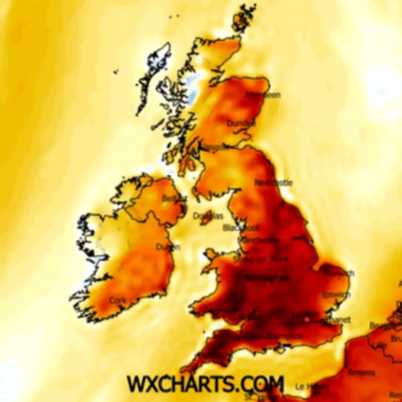
Notably, this forecast would make the UK warmer than popular European holiday destinations. For instance, temperatures in Ibiza are only expected to reach 17C to 18C on the same days, while Zante is predicted to peak at 21C. Temperature anomaly maps from the ECMWF weather model support this outlook, showing deep red areas across England and Wales on Wednesday, indicating temperatures well above the seasonal average.
BBC Forecast and Long-Term Outlook
BBC forecasters also anticipate sunny skies and warm conditions next week. They predict easing winds on Monday with plenty of sunshine, followed by breezier and warmer weather on Tuesday and Wednesday. Looking further ahead, the Met Office warns of a changeable pattern for early to mid-April, with Atlantic frontal systems bringing occasional rain or showers, strongest in the west and northwest.
While temperatures are expected to be close to average overall, there may be opportunities for short-lived warm spells in the south and east. Conversely, colder interludes in the northwest could bring wintry showers, especially to hilly areas, and overnight frost. This mixed outlook highlights the unpredictable nature of spring weather in the UK.