
The Met Office has forecast that the North East will see temperatures climb to 26°C on Thursday, July 9, as a new heatwave approaches the UK. This follows a cooler week that brought thunderstorms to the region, after England recorded its warmest June on record.
Weekend and Early Next Week Weather
This weekend, the North East will see highs of 21-22°C, though breezy conditions will make it feel fresher, with showers expected on both Saturday and Sunday. The wet weather is set to continue into early next week, with more spells of rain in parts on Monday and Tuesday.
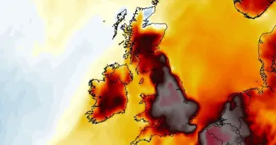
Wednesday marks a shift towards sunnier and drier weather, with highs of 25°C forecast in Newcastle. Thursday is currently expected to be the warmest day of the week, with the mercury climbing to 26°C in the city, surpassing the heatwave threshold of 25°C. Met Office weather maps show highs ranging from 22°C in northernmost Northumberland to 26°C in County Durham on Thursday afternoon, accompanied by largely dry and sunny conditions.

Broader UK Outlook
The Met Office said in an update on Friday: "Looking ahead, inland temperatures are forecast to rise again next week, with parts of England potentially reaching low 30s in the southeast. While the likelihood of reaching the extreme temperatures and humidity levels observed last week is currently low, a renewed period of warm weather is in the forecast."
This comes after England recorded its warmest June on record last month, following an "exceptional" heatwave that sparked a rare Red Warning from the Met Office for extreme heat on three consecutive days. The highest temperature ever recorded in June in the UK was reached on June 26, hitting 37.7°C in Norfolk.
Impact on Marine Heatwave
The heatwave has also affected the seas around the UK, which are currently experiencing "moderate to severe" marine heatwave conditions and are on average 2°C warmer than usual. Waters off the English and Welsh coasts are currently between 15 and 19°C. If temperatures rise to heatwave levels again next week, the sea surface will have limited opportunity to cool.
"This raises the possibility that the current marine heatwave could intensify further, potentially reaching Category 4, classified as 'extreme' - a level rarely recorded in UK waters," the Met Office explained.
Cold-Water Shock Warning
However, Holly Clements, Met Office Head of Warnings and Guidance, said: "It is vital for the public to understand that although sea-surface temperatures are currently well above average in many coastal locations, this does not avoid the risk of cold-water shock. With warmer weather approaching, and even with marine heatwave conditions, it's important to remember that the water around the UK is still cold. Entering it unexpectedly can lead to cold-water shock."