
The Met Office has detailed specific locations across the United Kingdom where snowfall is anticipated before Saturday, identifying ten distinct areas that could experience wintry flurries. This announcement follows a series of active weather warnings issued throughout the week, addressing hazards from ice, snow, and persistent rain.
Immediate Snow Forecast for Friday
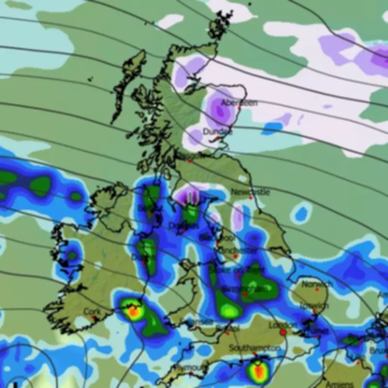
Although a previous snow warning for the Pennines, which predicted accumulations of up to 15 centimetres, has now lapsed, the national weather agency indicates that further snowfall remains a possibility today. The general forecast for Friday suggests that rain will dominate across most regions, but wintry showers are likely to affect certain elevated areas.
The Met Office specifically highlights that "Scottish hills" are the most probable locations to encounter snow today. The forecast summary explains: "Friday will see rain in most areas, with snow over Scottish hills, and remaining rather windy. Brighter in the northwest. Bright spells, but with heavy showers towards the southwest later."

List of Affected Council Areas
These Scottish mountainous regions encompass ten local authority districts where residents should prepare for potential snowfall. The areas identified by the forecast include:
- Highland
- Aberdeenshire
- Perth and Kinross
- Argyll and Bute
- Angus
- Moray
- Dumfries and Galloway
- Scottish Borders
- South Lanarkshire
- East Ayrshire
Meanwhile, brighter conditions are expected in the north-west of the country, though heavy rain is forecast to move into the south-west later in the day.
Extended Outlook and Further Wintry Risks
Looking ahead to next week, additional snowfall appears probable. According to the BBC Weather forecast for the period of February 9 to 15, changeable conditions will persist across the UK.
The outlook states: "Changeable conditions are expected. England and Wales should expect normal or above average amounts of rainfall, with further risks of some heavy rain and local risks of flooding, especially in south-western areas."
It further notes: "The northern edges of any precipitation bands will still be susceptible to snow as they move into the colder air, mostly on northern hills. The northward extent remains uncertain but there will be wintry showers across northern regions nonetheless, potentially to lower levels in Scotland, although here the north-west should be drier than normal."
This indicates that while the primary snow risk today is concentrated over Scottish highlands, the potential for wintry weather, including snow reaching lower elevations in Scotland, extends into the following week, maintaining a focus on northern parts of the UK.


