
Spring's Warm Welcome Turns Wintry as UK Braces for Snow and Storms
Spring officially arrived in Britain over a week ago, bringing unseasonably warm conditions with temperatures nudging 20C in some areas. However, forecasters are now warning that winter has not fully relinquished its grip, with a significant cold snap set to bring snow, heavy rain, and powerful gales across the country later this week.
Dramatic Temperature Drop and Wintry Hazards Ahead
The Met Office has indicated that the coming days will showcase 'typical early spring conditions' initially, but 'wintry hazards' are expected to develop, particularly across northern and western regions. Daytime temperatures will struggle to reach double figures from Thursday onwards, marking a stark contrast to recent warmth.
Forecasters predict that snow could accumulate on hills and mountains above 200m (650ft) in the North, while brief flurries of wet snow are possible in southern areas, though unlikely to settle. Rainfall totals could reach 30mm to 50mm over saturated ground in places like the Lake District, with similar amounts possible further south.

Timeline of Disruptive Weather Patterns
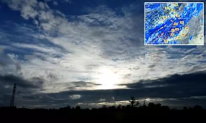
Today will see cloudy conditions for many as an occluded front moves eastward, bringing rain that will gradually spread but weaken. Increasing wind speeds will break up cloud cover later, with further rain hitting western areas this evening, locally heavy with gales in the far North West.
Tomorrow morning, rain and cloud will clear from the South East by mid-morning, leaving sunny spells for many but also blustery showers, most frequent across western Scotland. The South East may enjoy above-average temperatures of around 15C, while the North West will be cooler with maximums in the high single figures.
Thursday will bring bright spells possible in the South and East, but most areas will experience cloudy conditions with brisk winds and rain, heaviest over western hills. Blustery showers will follow into the North West with snow possible on Scottish mountains, and gales expected on exposed coasts and hills.
Weekend Brings Potentially Severe Conditions
A notable shift in weather patterns is expected by Friday, as a north-westerly flow brings markedly colder conditions nationwide. Temperatures will struggle to get out of single figures for most of the country, with the potential for sunny spells, heavy showers, coastal gales, and snow over high ground.
Met Office chief operational meteorologist Jason Kelly emphasized: 'A notable shift in wind direction to a north-westerly flow will bring a markedly colder day nationwide on Friday, with the potential for a mixture of sunny spells, heavy showers, coastal gales, and snow over high ground. There's also the possibility of accumulations on lower hills.'
Meteorologist Annie Shuttleworth added in a forecast video: 'A notable change in the air mass on Thursday night into Friday will bring a very different feel to the weather by the end of the week. Considerably colder to start the day. We are expecting a patchy frost particularly in sheltered areas.'
The weekend could see a low pressure area strike the UK, bringing gusts of 40-50mph for many areas and potentially reaching 60mph in exposed parts of the North West. Shuttleworth noted that northwestern areas will see frequent showers, some falling as snow to around 200 meters, with a mix of hail creating ice risks through Friday and Saturday mornings.
Recent Warmth Provides Stark Contrast
This impending cold snap follows what has been an unusually warm start to spring. Last Thursday marked the UK's warmest day of 2026 so far, with temperatures reaching 19.2C in London, surpassing the previous high of 18.7C recorded on February 25.
Areas of southern England also experienced spectacular sunsets last week, caused by dust from the Saharan desert being blown across Europe toward the UK. This phenomenon can create 'blood rain' when the dust interacts with downpours.

Travel and Safety Considerations
With the dramatic weather change approaching, experts are urging caution. Matt Crole-Rees, Confused.com car insurance expert, advised: 'As temperatures are expected to fall back to single digits across areas of the UK this week, drivers should be wary of potential changes in road conditions. While we've recently seen some spring-like warmth, the return of colder air, wet weather fronts and the possibility of sleet or snow showers could make journeys more challenging.'
The Met Office recommends keeping updated with forecasts as conditions develop, particularly regarding snow accumulations on lower hills and the timing of the strongest winds. Meteorological spring officially runs from March 1 to May 31 each year, following winter between December 1 and February 28 or 29.


