
UK Snow Maps Reveal Impending Blizzard Set to Bury 60% of Country in -12C Freeze
Advanced weather forecasting maps indicate a severe blizzard is poised to sweep across the United Kingdom, with snow expected to blanket approximately 60% of the nation, including major cities like London and Birmingham. This dramatic shift comes despite recent unseasonably warm weather, where temperatures soared above 19C in London earlier this week.
Timeline of the Snowfall Event
According to the GFS weather model, the initial wave of snow will commence around 9am on March 15. The heaviest accumulations are projected for northern Scotland initially, but flurries will quickly spread to affect Wales, Northern Ireland, and the north-west regions, with Manchester directly in the path of the storm.
In the early hours of March 16, a second, more intense wave of snow is forecast to move across southern England and Wales. Areas such as South Wales, Gloucestershire, and Hampshire are anticipated to experience the most significant snowfall at this stage.

By 3am on March 16, the most severe snow is expected to fall over London and Essex, with potential impacts extending to the Midlands, including Birmingham. As the day progresses, by 3pm, the snow is predicted to drift northwards, affecting North Wales, the Pennines, and Scotland once again.
Temperature Plunge and Coverage Details
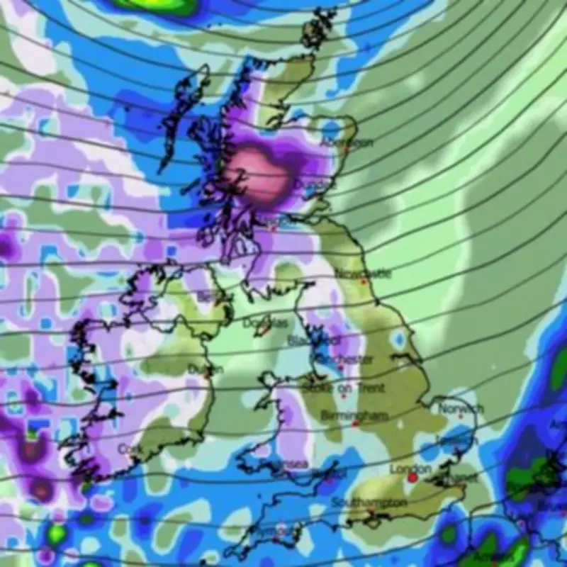
Snow coverage maps reveal that by 6am on March 16, vast swathes of southern England, the Midlands, Wales, the north-west, Northern Ireland, and Scotland will have settled snow on the ground. Accompanying this widespread snowfall, temperatures are forecast to plummet dramatically.
Data suggests that the far north of Scotland could see lows as frigid as -12C, while Northern Ireland and northern England may experience temperatures dropping to -3C. Wales is expected to face lows around -5C, highlighting the severity of the cold snap.
Official Weather Warnings and Forecasts
The Met Office has issued a warning regarding a potential colder spell later this month, though it is anticipated to occur after March 20. Their forecast for the period from March 20 to April 4 indicates unsettled conditions with spells of rain and strong winds, particularly in western areas, before a possible shift to drier weather in the north and cooler temperatures towards the month's end.
Similarly, BBC Weather has cautioned about wintry showers, especially over higher ground in the north, as cooler overall temperatures and showery weather systems move in from the Atlantic during the week of March 16 to 22.
This impending blizzard marks a stark contrast to the recent warmth, underscoring the volatile nature of UK weather patterns as spring approaches.


