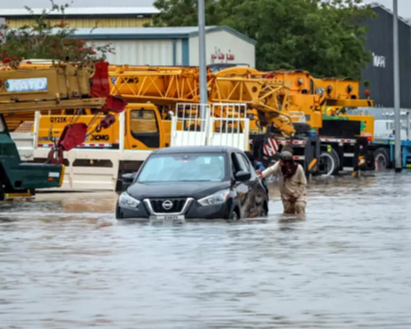
Unusual Jet Stream Triggers Severe Thunderstorms and Flooding Across Middle East
An unusual weather pattern, driven by an abnormally strong jet stream, has unleashed severe thunderstorms across parts of the Middle East last week, battering countries including the United Arab Emirates and Saudi Arabia. The Arabian peninsula, typically dominated by arid desert climates, received up to 150mm of rain in just a few days, causing widespread disruption and flooding.
Intense Storms and Record Rainfall
The deluge was caused by an abnormally strong jet stream, which helped a deep area of low pressure to develop north of Saudi Arabia. This, in turn, drew moist tropical air from the Indian Ocean and triggered intense storms. In Oman, hailstones as large as tennis balls fell during Wednesday evening's storms, alongside torrential rain. Doha, Qatar's capital, experienced significant flooding on the same day.
Further thunderstorms developed on Thursday evening, with a more organised line crossing the UAE and hitting densely populated areas such as Dubai and Abu Dhabi. Gusts of up to 80mph, large hail, and intense lightning were reported, as heavy rainfall led to extensive flooding in urban and rural areas.

Historical Context and Climate Implications
While thunderstorms are not rare in the region, the multiday nature of last week's deluge is more commonly seen in the US and central Europe in spring and summer. A weather station on Jebel Yanas in northern UAE recorded 244mm of rainfall, with many others exceeding 100mm in just a few days. This far surpasses typical annual totals of 60-100mm for the area.
The event reflects a broader global trend of storms bringing more intense rainfall as the climate warms, highlighting the increasing vulnerability of arid regions to extreme weather events. This pattern underscores the need for enhanced preparedness and infrastructure to mitigate future risks.
Regional Impacts and Future Outlook
Attention is now shifting to the Mediterranean, where a developing low-pressure system south-east of Italy is expected to bring heavy rain and thunderstorms to Greece, Turkey, and other countries in south-east Europe this week. Rainfall totals could reach 100mm in places on Tuesday and Wednesday, raising the risk of flooding.
Additionally, 60-80mph gusts may affect parts of northern Africa, including Libya, which was recently hit by Storm Samuel, a similar system. This ongoing weather activity suggests a volatile pattern across the region, with potential for further severe events in the coming days.
As communities in the Middle East recover from the flooding, meteorologists continue to monitor these developments closely, emphasising the importance of early warnings and adaptive strategies in the face of changing climate dynamics.