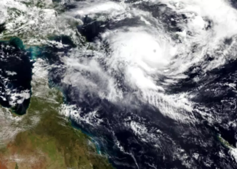
Severe Tropical Cyclone Maila Intensifies to Category Five Ahead of Australian Landfall
Severe Tropical Cyclone Maila has intensified to a category five storm over the Solomon Sea, marking it as one of the strongest systems this Australian cyclone season. The storm is forecast to make landfall along the far north Queensland coast early next week, bringing significant risks of heavy rain, flooding, and hazardous surf to communities already saturated from recent weather events.
Impacts and Forecast for Queensland
According to the Bureau of Meteorology, Maila was located over the Solomon Sea on Wednesday and is expected to hit the Cape York peninsula, likely between the Lockhart River and Cairns, by Monday. Senior meteorologist Ilana Cherny noted that the cyclone has recorded a lower minimum pressure of 924hPa compared to the recent Severe Tropical Cyclone Narelle, which measured 930hPa, indicating greater intensity. However, the storm is predicted to weaken as it moves south-west towards Australia, though uncertainties remain due to its potential path near Papua New Guinea.
Queensland could start experiencing impacts from the weekend onwards, including strong winds and flood risks in already waterlogged catchments. Cherny emphasized that this is the seventh storm to reach severe tropical cyclone strength—above category three—this season, which runs from November to April. Historically, only about three or four of the ten tropical cyclones in the Australian region each season make landfall, with roughly five reaching severe intensity.

Comparison with Previous Cyclones and Regional Effects
Maila follows a similar path to Severe Tropical Cyclone Narelle, which made landfall on 20 March as a category four system and was the first in over two decades to affect three Australian states and territories. Meanwhile, another major storm, Severe Tropical Cyclone Vaianu, is expected to hit New Zealand around the same time, having been a category three system near Fiji. The New Zealand MetService warns of damaging winds as it transitions into an extra-tropical cyclone.
In the Solomon Islands, Maila's effects were already being felt on Wednesday, with social media images showing property destruction in remote provinces. Professor Liz Ritchie-Tyo from Monash University explained that cyclones like Maila and Narelle form near the equator and are steered westward towards Australia by circulation patterns. She highlighted that global heating may reduce cyclone frequency but increase their intensity, with slower-moving storms prolonging impacts on land.
Broader Context and Adaptation Challenges
Preliminary observations suggest that cyclones are moving slower, leading to longer-lasting effects and slower weakening after landfall. This poses adaptation challenges, as communities may need to prepare for sustained strong winds inland, where infrastructure is less resilient. The Australian cyclone season has seen multiple landfalls this year, including Tropical Cyclone Koji, which was downgraded before hitting in January.
As Maila approaches, authorities urge vigilance in Queensland, with ongoing monitoring of its trajectory and strength. The storm underscores the increasing intensity of weather events in a changing climate, emphasizing the need for robust preparedness and adaptation strategies in vulnerable regions.