The Met Office has escalated weather warnings for the UK, issuing a fresh alert for snow and ice this Sunday. This comes as the nation continues to grapple with the significant fallout from Storm Goretti, which brought destructive winds and widespread power cuts.
Weekend Weather Warnings Escalate
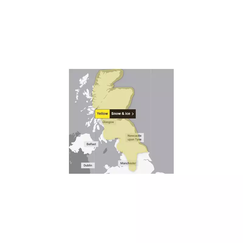
Following a rare red warning for wind in the South West, forecasters have now placed a yellow warning for snow and ice across northern England and Scotland. This alert is active from 2am until 3pm on Sunday, January 11th. The Met Office warns that a band of snow will sweep across the region, likely causing considerable travel disruption.
This new threat compounds an already difficult situation. Storm Goretti, named by Météo-France, battered the UK with gusts approaching 100mph. The National Grid reported that at the peak of the storm on Friday evening, over 30,000 properties were without power in the South West, with thousands more affected in the West Midlands, East Midlands, and Wales.

Disruption and Danger from Snow and Ice
The impending wintry weather is expected to cause fresh problems. Forecasters predict that the snow could lead to travel delays on roads, with the potential for vehicles and passengers to become stranded. Services by rail, air, and bus may also face delays or cancellations.
Beyond travel, there is a heightened risk of injuries from slips and falls on icy surfaces. The Met Office also cautions that further power cuts may occur. The amount of snowfall will vary significantly with elevation. While low-lying areas in northern England may see 2-5cm, accumulations above 200 metres could reach 10-20cm, and up to 30cm on the highest Scottish hills. Strong winds will likely cause drifting snow.
Nationwide Impact and Forecast
The areas under the Sunday warning are extensive, covering parts of Central, Tayside and Fife, East Midlands, Grampian, Highlands and Eilean Siar, North East England, North West England, Orkney and Shetland, South West Scotland, Lothian Borders, Strathclyde, West Midlands, and Yorkshire and Humber.
Met Office Chief Forecaster Steve Willington stated: "A front from the west on Sunday will bring snow for parts of Scotland and northern England with low temperatures continuing the ice risk... With much of this falling in areas that have already seen severe snowfall, ongoing disruption is likely." He added that central and southern England and Wales will see rain instead.
The broader outlook indicates that after a largely dry Saturday for many, Sunday will be wet and windy for most of the country, with hill snow in the north. Conditions are expected to turn milder by Monday and Tuesday.