
Met Office Issues Urgent Snow and Ice Warning Across Scotland
The Met Office has issued an urgent weather warning for snow and ice, covering 11 specific areas across Scotland. This alert is in effect from 3pm today until 10am tomorrow, spanning a total of 19 hours. Britons are being advised to prepare for significant wintry conditions, with temperatures expected to plummet well below freezing levels.
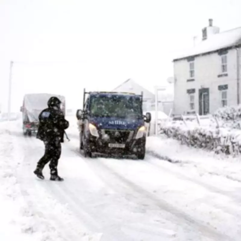
Potential for Three Inches of Snow and Travel Disruption
According to the national weather agency, accumulations of up to 8cm, equivalent to three inches, are possible in some locations. The heaviest snowfall is anticipated in Scotland, where the warning also includes rain and sleet. Motorists have been urged to exercise extreme caution on the roads due to the likelihood of icy surfaces and reduced visibility.
The Met Office has explicitly warned of potential travel disruption across various modes of transport. Longer journey times are expected for road, bus, and train services. Additionally, there is an increased risk of injuries from slips and falls on untreated icy surfaces.

Detailed Forecast and Affected Regions
The official warning states: "Periods of rain, sleet and snow will spread southeastwards across Scotland at times through Monday and Monday night, accumulating snow initially on hills (typically above 200 m elevation) but falling to lower levels at times later in the day and overnight."
It further explains: "Further scattered wintry showers will arrive from the northwest later in the night and into Tuesday morning. The greatest accumulations of snow will be during Monday evening and night, where 1-2 cm will be possible in places at low levels (away from north-facing coasts), 2-5 cm above about 150 m elevation and 5-8 cm above 300 m."
With temperatures dropping below freezing, ice is likely to form on untreated surfaces, even in areas where precipitation falls as rain or sleet. The forecast also notes the possibility of isolated lightning strikes and strong north to northwesterly winds, with gusts potentially reaching 50-60 mph in exposed regions such as the Northern Isles and northeastern parts of the mainland.
List of Areas Under the Snow and Ice Warning
- Central, Tayside & Fife: Angus, Perth and Kinross, Stirling
- Grampian: Aberdeen, Aberdeenshire, Moray
- Highlands & Eilean Siar: Na h-Eileanan Siar, Highland
- Orkney & Shetland: Orkney Islands, Shetland Islands
- Strathclyde: Argyll and Bute
Residents in these regions are strongly advised to stay updated with the latest weather reports and plan their travel accordingly to ensure safety during this period of adverse weather conditions.


