
The Met Office has issued a significant yellow weather warning for wind across extensive parts of Scotland, with severe gales anticipated to reach speeds of up to 70 miles per hour. This alert is in effect from midnight on Wednesday through to midday, specifically targeting regions including Na h-Eileanan, Highland, Orkney Islands, and Argyll & Bute.
Forecast Details and Expected Impact
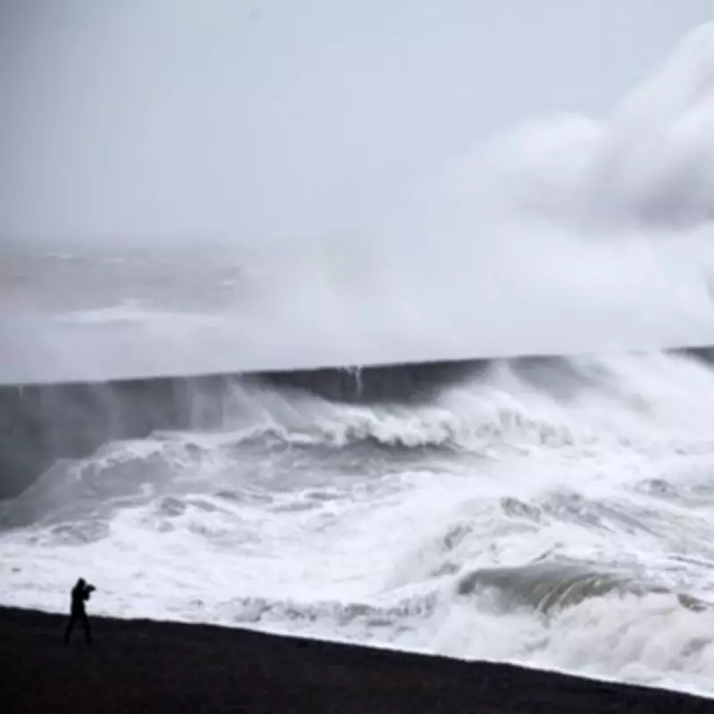
Forecasters have warned that a period of severe gales is likely to develop overnight from Tuesday into Wednesday across the Outer and Inner Hebrides. These powerful winds will steadily move northeast across other exposed areas of northwest mainland Scotland and into Orkney during Wednesday morning. Gusts of 65 to 70 mph are expected, with a small possibility that some locations could experience gusts approaching 75 to 80 mph.
Potential Disruptions and Safety Advice
The Met Office has cautioned that disruption to road, rail, air, and ferry services is possible. Brief power cuts and interruptions to other utilities are also likely. Coastal roads, seafronts, and seaside communities may face hazards from spray and large waves. Residents in the affected areas are urged to monitor road conditions and adjust travel plans if necessary.

In preparation for potential power outages, locals are advised to assemble essential items such as torches, batteries, and mobile phone power packs. This proactive measure can help ensure safety and communication during the severe weather event.
Affected Regions and Local Authorities
The warning impacts several key regions and local authorities, including:
- Highlands & Eilean Siar
- Na h-Eileanan Siar
- Highland
- Orkney & Shetland
- Orkney Islands
- Strathclyde
- Argyll and Bute
Broader Weather Context and Upcoming Conditions
This period of severe wind comes ahead of an expected fierce blizzard that is forecast to affect approximately 60% of the country. At least 13 cities across the UK are set to experience snow, with parts of the Northwest of England likely to bear the brunt of the inclement weather on Friday.
Weather maps from WXCharts indicate that areas ranging from Wick in Scotland to Manchester will be covered under layers of snow when the blizzard is at its most widespread and intense. Several parts of Scotland, including Wick, Inverness, Fort William, Aberdeen, Dundee, and Glasgow, are likely to witness snow showers according to these projections.
The combination of strong winds and impending snowfall underscores the need for vigilance and preparedness across the UK. The Met Office continues to monitor the situation closely, providing updates to help the public stay informed and safe during these challenging weather conditions.


