The return to school for thousands of children across Scotland's Highlands and Islands is under severe threat this week as heavy snowfall and treacherous ice create dangerous travel conditions.
Widespread Disruption and School Closures
Pupils in Orkney, Shetland, and Aberdeenshire are scheduled to return to their desks on Monday following the Christmas break. However, with up to 15 inches (37cm) of snow already on the ground and a grim weekend forecast, local authorities warn that road travel could be perilous. Decisions on school closures are largely down to individual head teachers, with councils stating it is too early to confirm exact numbers.
Schools in the wider Highland region are not due back until Wednesday, by which time conditions may have improved. The north-east of Scotland bore the brunt of the snowfall since New Year. The village of Tomintoul in Banffshire endured the heaviest fall, recording 14.5 inches (37cm). Aboyne in Aberdeenshire saw eight inches (20cm), while Loch Glascarnoch in Ross and Cromarty witnessed 19cm.
Met Office Warnings and Travel Chaos
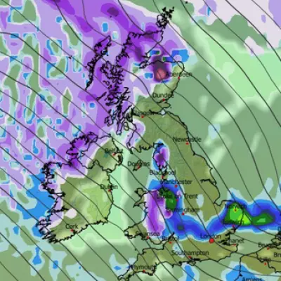
The Met Office has issued snow and ice warnings for northern Scotland above the central belt, effective until noon on Monday. The alert area includes the Western Isles, Orkney, and Shetland. Forecasters warn of an additional 2 to 5cm of snow, potentially reaching 10-15cm in low-lying areas. Above 200 metres, accumulations could hit 15-30cm, particularly in the northwest Highlands and Grampians.
The white-out conditions have sparked significant travel chaos. In Huntly, Aberdeenshire, a doctor's car became stuck in snow near the train station on Friday night. Dr Naveed Khan faced spending the night in his vehicle amid plummeting temperatures before eventually receiving help from a local resident. Major transport operators have also been affected. ScotRail announced several cancellations on services including Wick and Inverness, while Avanti West Coast reported blocked lines to Glasgow Central and Edinburgh due to overrunning engineering work.
Bitterly Cold Outlook for the UK
An Arctic air mass has plunged much of the UK into sub-zero temperatures. Loch Ness recorded a low of nearly -6C (21F) on Friday night. Daytime temperatures on Sunday are expected to remain in the low single figures for most, staying below freezing in parts of northern Scotland.
Met Office Chief Meteorologist Rebekah Hicks stated: ‘Arctic air and brisk northerly winds are gripping the UK as we start the new year. Bitterly cold conditions will persist through the weekend and into next week, with daytime temperatures struggling to rise above freezing for some.’ The warnings also highlight risks of some rural communities being cut off, power cuts, and temporary blizzard conditions due to drifting snow.


