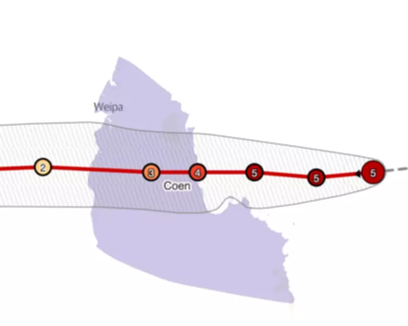
A tracking map reveals the projected trajectory of Tropical Cyclone Narelle as it nears the Australian coastline, with the storm anticipated to strike Queensland early Friday morning. Wind speeds are predicted to reach up to 225 kilometres per hour (140 miles per hour), posing significant threats to the region.
Cyclone Narelle's Path and Intensity Forecast
The Bureau of Meteorology indicates that Tropical Cyclone Narelle intensified to a category-five system while traversing the Coral Sea. It is expected to cross the coast as a category-four cyclone, delivering destructive wind gusts exceeding 225km/h. The storm is set to make landfall in far north Queensland on Friday morning before progressing across the Gulf of Carpentaria and towards the Northern Territory in subsequent days.
Official Warnings and Community Preparedness
Queensland Premier David Crisafulli addressed reporters on Thursday, urging residents to brace for severe impacts, including strong winds, heavy rainfall, storm surges, and flash flooding. He emphasised the rarity and seriousness of the event, noting that a category-five system crossing the Queensland coast would mark only the fourth such occurrence in fifty years. Crisafulli cautioned against underestimating the cyclone, stating that damage is likely to be widespread and advising the public to take all necessary precautions.

Tracking and Updates
Authorities will periodically update the tracking map with the latest forecasts to monitor Cyclone Narelle's path. Residents are encouraged to stay informed through official channels as the situation evolves. This developing story underscores the critical need for vigilance and preparedness in the face of extreme weather events.