Far North Queensland on High Alert as Tropical Low Triggers Severe Flood Warnings
Residents in far north Queensland are being instructed to seek higher ground immediately as a severe weather system approaches, bringing with it the threat of heavy rain and dangerous flash flooding. The region is bracing for a tropical low predicted to cross the coast by Friday afternoon, specifically between Cairns and Townsville, before moving southwest into central Queensland over the weekend.
Emergency Measures and Warnings in Place
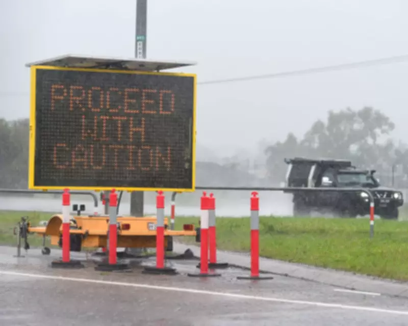
Police issued a flood emergency warning for the Daintree River late on Thursday, noting that flash flooding was already occurring and urging residents to move to safety. In response, sandbag stations have been established across affected areas to help communities prepare for the impending deluge. The Bureau of Meteorology has forecast up to 240mm of rain within a six-hour period on Friday, which could lead to life-threatening flash flooding.
Local infrastructure has already felt the impact of the wild conditions. For instance, the Daintree ferry came loose from its moorings due to the severe weather. Douglas Shire mayor Lisa Scomazzon stated that council and emergency crews plan to retrieve the vessel once conditions permit, emphasizing the need for patience during this major flooding event.

Community Preparedness and Regional Impacts
Authorities have cancelled a cyclone watch for the region after determining the system has a very low chance of intensifying before landfall. However, residents are advised to have emergency plans ready, stock up on supplies, and be prepared to evacuate if necessary. Cassowary Coast mayor Teresa Millwood reported that emergency services are on standby in Innisfail and Cardwell, with sandbag stations available for those in need.
Hinchinbrook Shire mayor Ramon Jayo highlighted that his community, still recovering from a major flood earlier in the week, is bracing for more heavy rain and high winds. He noted that residents are restocking pantries in anticipation of being stranded by floodwaters.
Broader Weather Impacts Across Queensland
The severe weather is not confined to far north Queensland. According to the Bureau of Meteorology's Angus Hines, the coast from Townsville down to Mackay is also at risk, with heavy falls expected to extend through the Central Coast, Capricornia, and into the Wide Bay region around Bundaberg and Hervey Bay. Southeast Queensland may experience impacts over the weekend, prompting residents to monitor forecasts closely, especially for rain on Sunday.
As the tropical low, described as "disconnected," makes its way inland, emergency services remain on high alert, urging all residents to stay informed and take necessary precautions to ensure safety during this critical period.