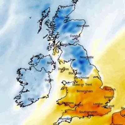
A cold snap is gripping the United Kingdom this week, bringing temperatures several degrees below the mid-May average, particularly across the Midlands and northern regions. Forecasters have warned of outbreaks of hail and thunder amid heavy showers, as northerly winds drag cold air from northern Scandinavia and the Arctic.
Current Conditions
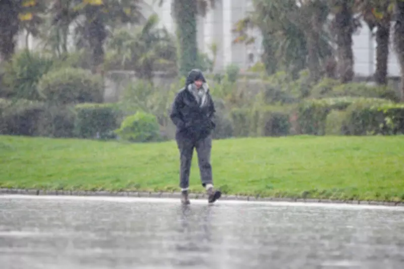
Wednesday saw blustery showers across the country, with a heightened risk of heavy rain and hail in eastern areas. Temperatures hovered around 14C in the south west, while parts of Scotland recorded just 9C. The unseasonably cool weather is expected to persist, with wet and windy conditions continuing into Thursday.
Thursday and Beyond
Heavy, thundery showers are forecast across England and Scotland on Thursday, with temperatures remaining cool. However, the outlook for Friday and Saturday suggests drier conditions, though still cool. Warmer weather is predicted by the end of next week, with temperatures potentially exceeding 20C for the bank holiday weekend.

In full, a cold front is moving across the UK, bringing a mix of rain, hail, and thunder. Residents are advised to prepare for the unseasonable conditions and stay updated with local weather warnings.